River Systems and Watersheds of Alabama
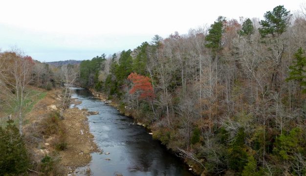
 Cahaba River
Alabama's river drainages and abundant water resources are one of the state's most distinctive natural features. In creating the original "Great Seal of the State of Alabama," Gov. William Wyatt Bibb included Alabama's main river channels in the design, forever imprinting the strategic importance of rivers to Alabama's future. He could not have known at the time that the great Mobile River basin, which covers some two-thirds of the state, has a greater yield of water per square mile of land than any other basin in the United States, including the Mississippi River. Nor could he have guessed that Alabama's springs, streams, rivers, lakes, and wetlands are home to more species of aquatic and semi-aquatic animals than any other state in the union. The abundance and high-quality of Alabama's water resources helped determine the location of many settlements, towns, and eventually cities, contributed significantly to the economic development of the state, and will be a catalyst in Alabama's future as an emerging Sunbelt state.
Cahaba River
Alabama's river drainages and abundant water resources are one of the state's most distinctive natural features. In creating the original "Great Seal of the State of Alabama," Gov. William Wyatt Bibb included Alabama's main river channels in the design, forever imprinting the strategic importance of rivers to Alabama's future. He could not have known at the time that the great Mobile River basin, which covers some two-thirds of the state, has a greater yield of water per square mile of land than any other basin in the United States, including the Mississippi River. Nor could he have guessed that Alabama's springs, streams, rivers, lakes, and wetlands are home to more species of aquatic and semi-aquatic animals than any other state in the union. The abundance and high-quality of Alabama's water resources helped determine the location of many settlements, towns, and eventually cities, contributed significantly to the economic development of the state, and will be a catalyst in Alabama's future as an emerging Sunbelt state.
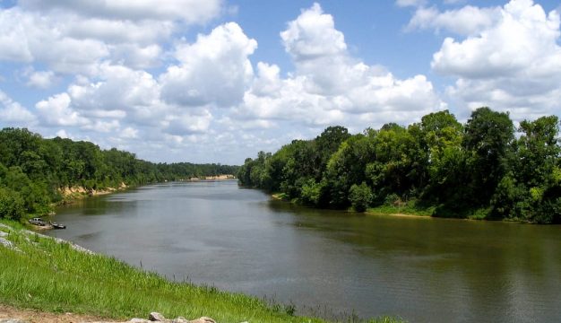
 Chattahoochee River
A basin is a land area drained by a river or stream and its tributaries. The basin includes both the channels that convey the water and the land surfaces that collect and funnel water into those channels. Each of the basins is separated from each adjacent basin by an intervening topographically high area. Drainages in the state can be classified geographically into three broad areas: the Tennessee River drainage in the north, the Mobile River basin in the central region, and the coastal drainages in the south, from the Escatawpa River in the southwest to the Chattahoochee River in eastern Alabama. An estimated 132,000 miles of river and stream channels, representing the state's 17 major river systems, are carved into Alabama's landscape, with about 61 percent flowing permanently throughout the year and 39 percent flowing only intermittently during wetter times. At 1,438 miles, Alabama leads the nation in miles of navigable channels, with 16 lock-and-dam structures on six river systems. More than 20 hydroelectric generating facilities and 20 or more impoundments on smaller streams for public water supply have been built throughout the state. The total surface area of lakes, ponds, and reservoirs is 563,000 acres, and about 33.5 trillion gallons of water flow through Alabama's river and stream channels every year. Also, Alabama's underground water supplies are estimated at about 553 trillion gallons, or more than 16 times the amount of surface water.
Chattahoochee River
A basin is a land area drained by a river or stream and its tributaries. The basin includes both the channels that convey the water and the land surfaces that collect and funnel water into those channels. Each of the basins is separated from each adjacent basin by an intervening topographically high area. Drainages in the state can be classified geographically into three broad areas: the Tennessee River drainage in the north, the Mobile River basin in the central region, and the coastal drainages in the south, from the Escatawpa River in the southwest to the Chattahoochee River in eastern Alabama. An estimated 132,000 miles of river and stream channels, representing the state's 17 major river systems, are carved into Alabama's landscape, with about 61 percent flowing permanently throughout the year and 39 percent flowing only intermittently during wetter times. At 1,438 miles, Alabama leads the nation in miles of navigable channels, with 16 lock-and-dam structures on six river systems. More than 20 hydroelectric generating facilities and 20 or more impoundments on smaller streams for public water supply have been built throughout the state. The total surface area of lakes, ponds, and reservoirs is 563,000 acres, and about 33.5 trillion gallons of water flow through Alabama's river and stream channels every year. Also, Alabama's underground water supplies are estimated at about 553 trillion gallons, or more than 16 times the amount of surface water.
Tennessee River Drainage
 Tennessee River
The waters of the Tennessee River originate in Virginia, North Carolina, and Tennessee and flow southwest into north Alabama before turning northwest and leaving the state at the Alabama-Mississippi-Tennessee border toward its juncture with the Ohio River. The main channel of the Tennessee River is impounded along its entire length in Alabama, creating four reservoirs within state boundaries: Pickwick Lake, Wilson Lake, Wheeler Lake, and Lake Guntersville. All are operated by the Tennessee Valley Authority (TVA) and have a combined surface area of 195,200 acres. These lakes and projects greatly expanded the economy of the region in the early twentieth century and have provided flood control, electrical power generation, navigation, and recreational opportunities for generations of Alabamians throughout the watershed. The Tennessee River enters Alabama with an average flow of more than 37,600 cubic feet per second (cfs) and adds about 14,000 cfs of stream flow on its journey through the state. Within the state's boundaries, the Tennessee River drains approximately 6,800 square miles or about 13 percent of Alabama's total land area.
Tennessee River
The waters of the Tennessee River originate in Virginia, North Carolina, and Tennessee and flow southwest into north Alabama before turning northwest and leaving the state at the Alabama-Mississippi-Tennessee border toward its juncture with the Ohio River. The main channel of the Tennessee River is impounded along its entire length in Alabama, creating four reservoirs within state boundaries: Pickwick Lake, Wilson Lake, Wheeler Lake, and Lake Guntersville. All are operated by the Tennessee Valley Authority (TVA) and have a combined surface area of 195,200 acres. These lakes and projects greatly expanded the economy of the region in the early twentieth century and have provided flood control, electrical power generation, navigation, and recreational opportunities for generations of Alabamians throughout the watershed. The Tennessee River enters Alabama with an average flow of more than 37,600 cubic feet per second (cfs) and adds about 14,000 cfs of stream flow on its journey through the state. Within the state's boundaries, the Tennessee River drains approximately 6,800 square miles or about 13 percent of Alabama's total land area.
Mobile River Basin
 Tombigbee River
The Mobile River basin drains an area of 43,680 square miles in Alabama, Mississippi, Tennessee, and Georgia. In Alabama, the Mobile River basin drains approximately 32,700 square miles, or 63 percent of Alabama's total land area. The western part of the basin is comprised of the upper Tombigbee River (3,650 square miles inside Alabama), the Black Warrior River (6,274 square miles), and, below the confluence of these two river systems, the lower Tombigbee River (4,044 square miles inside Alabama). More than 82,000 acres of impoundments are found in the western Mobile basin, with Lewis Smith Lake on the Sipsey Fork of the Black Warrior River being the largest at more than 21,000 acres. The series of impoundments created by completion of the Tennessee-Tombigbee Waterway are navigable and connect the Mobile River basin with the Tennessee River drainage in northeast Mississippi. The upper Tombigbee skirts the Fall Line Hills physiographic district and the lower Tombigbee crosses lower Coastal Plain physiographic districts before reaching its confluence with the Alabama River. The upper reaches of the Black Warrior River system drain the Cumberland Plateau in Jefferson, Cullman, Walker, and Tuscaloosa counties, and the lower reaches drain the upper Coastal Plain.
Tombigbee River
The Mobile River basin drains an area of 43,680 square miles in Alabama, Mississippi, Tennessee, and Georgia. In Alabama, the Mobile River basin drains approximately 32,700 square miles, or 63 percent of Alabama's total land area. The western part of the basin is comprised of the upper Tombigbee River (3,650 square miles inside Alabama), the Black Warrior River (6,274 square miles), and, below the confluence of these two river systems, the lower Tombigbee River (4,044 square miles inside Alabama). More than 82,000 acres of impoundments are found in the western Mobile basin, with Lewis Smith Lake on the Sipsey Fork of the Black Warrior River being the largest at more than 21,000 acres. The series of impoundments created by completion of the Tennessee-Tombigbee Waterway are navigable and connect the Mobile River basin with the Tennessee River drainage in northeast Mississippi. The upper Tombigbee skirts the Fall Line Hills physiographic district and the lower Tombigbee crosses lower Coastal Plain physiographic districts before reaching its confluence with the Alabama River. The upper reaches of the Black Warrior River system drain the Cumberland Plateau in Jefferson, Cullman, Walker, and Tuscaloosa counties, and the lower reaches drain the upper Coastal Plain.
The eastern Mobile River basin is drained by the Alabama River (6,023 square miles), Cahaba River (1,818 square miles), Coosa River (10,161 square miles, with 5,400 square miles in Alabama), and Tallapoosa River (4,675 square miles, with 4,022 square miles in Alabama) and contains more than 170,000 acres of impoundments, almost double that found in the western Mobile basin. The largest impoundments are Lake Martin (39,000 acres) on the Tallapoosa River and Weiss Lake (30,000 acres) on the Coosa River. Impoundments on the Coosa and Tallapoosa rivers were constructed for hydroelectric generation and flood-control purposes and neither river is commercially navigable throughout its length. The Alabama River is navigable upstream to Montgomery.
 Cahaba Lilies
The Cahaba, Coosa, and Tallapoosa rivers flow over terrain underlain by carbonaceous and metamorphic rocks of the Valley and Ridge and Piedmont physiographic sections and, as such, generally have clearer waters as compared with the waters flowing over more easily eroded shales and sandstones in the Cumberland Plateau and sands and clays in the Coastal Plain. The Alabama River flows almost entirely within the Coastal Plain before reaching its confluence with the lower Tombigbee to form the Mobile River. The expansive Mobile-Tensaw Delta begins where the Mobile River splits into a braided network of several distributary systems. The Mobile, Middle, Tensaw, Apalachee, and Blakeley rivers contribute an average of 41 billion gallons per day of fresh water to Mobile Bay. The Alabama, Black Warrior, and Cahaba river watersheds are contained entirely within state boundaries.
Cahaba Lilies
The Cahaba, Coosa, and Tallapoosa rivers flow over terrain underlain by carbonaceous and metamorphic rocks of the Valley and Ridge and Piedmont physiographic sections and, as such, generally have clearer waters as compared with the waters flowing over more easily eroded shales and sandstones in the Cumberland Plateau and sands and clays in the Coastal Plain. The Alabama River flows almost entirely within the Coastal Plain before reaching its confluence with the lower Tombigbee to form the Mobile River. The expansive Mobile-Tensaw Delta begins where the Mobile River splits into a braided network of several distributary systems. The Mobile, Middle, Tensaw, Apalachee, and Blakeley rivers contribute an average of 41 billion gallons per day of fresh water to Mobile Bay. The Alabama, Black Warrior, and Cahaba river watersheds are contained entirely within state boundaries.
Coastal Drainages
 Pea River
The coastal river drainages include a series of smaller river basins emptying into the Gulf of Mexico. The Escatawpa and tributaries to the Chickasawhay River (767 square miles in Alabama) eventually flow into Pascagoula Bay in south Mississippi. The Perdido River (841 square miles in Alabama) forms the boundary between Alabama and the western Florida panhandle and eventually enters Perdido Bay, which empties into the Gulf at Alabama Point. The Escambia and Conecuh rivers (3,849 square miles), a small part of the Blackwater River (148 square miles), and the Yellow River (507 square miles) eventually empty into Pensacola Bay, while the Pea River joins with the Choctawhatchee River (3,130 square miles combined area in Alabama) at the state line and flows into Choctawhatchee Bay, which enters the Gulf near Destin, Florida. The Apalachicola River basin drains approximately 25 percent of Alabama's land area and includes western tributaries to the Chattahoochee River (2,574 square miles) and the headwaters of the Chipola River system in Houston County (258 square miles). Both systems eventually enter the Apalachicola River in Florida. Alabama has jurisdiction only over the tributaries entering the east side of the Chattahoochee River, whereas the state of Georgia has jurisdiction for the Chattahoochee River main channel. The topography of coastal drainages is generally unsuited for reservoir development and, consequently, only a few have been constructed in this region. Impoundments of significant size are Point A and Gantt lakes (about 1,300 surface acres combined) on the Conecuh River near Andalusia, Walter F. George Lake (45,180 acres) on the Chattahoochee River northeast of Dothan, and Big Creek Lake (3,600 acres) in Mobile County. The free-flowing nature, topography, and plant communities of coastal rivers and streams produces some of the most beautiful and scenic aquatic habitats in Alabama, with many having darkly stained waters that meander through forested swamps or flow over extensive sand and gravel shoals.
Pea River
The coastal river drainages include a series of smaller river basins emptying into the Gulf of Mexico. The Escatawpa and tributaries to the Chickasawhay River (767 square miles in Alabama) eventually flow into Pascagoula Bay in south Mississippi. The Perdido River (841 square miles in Alabama) forms the boundary between Alabama and the western Florida panhandle and eventually enters Perdido Bay, which empties into the Gulf at Alabama Point. The Escambia and Conecuh rivers (3,849 square miles), a small part of the Blackwater River (148 square miles), and the Yellow River (507 square miles) eventually empty into Pensacola Bay, while the Pea River joins with the Choctawhatchee River (3,130 square miles combined area in Alabama) at the state line and flows into Choctawhatchee Bay, which enters the Gulf near Destin, Florida. The Apalachicola River basin drains approximately 25 percent of Alabama's land area and includes western tributaries to the Chattahoochee River (2,574 square miles) and the headwaters of the Chipola River system in Houston County (258 square miles). Both systems eventually enter the Apalachicola River in Florida. Alabama has jurisdiction only over the tributaries entering the east side of the Chattahoochee River, whereas the state of Georgia has jurisdiction for the Chattahoochee River main channel. The topography of coastal drainages is generally unsuited for reservoir development and, consequently, only a few have been constructed in this region. Impoundments of significant size are Point A and Gantt lakes (about 1,300 surface acres combined) on the Conecuh River near Andalusia, Walter F. George Lake (45,180 acres) on the Chattahoochee River northeast of Dothan, and Big Creek Lake (3,600 acres) in Mobile County. The free-flowing nature, topography, and plant communities of coastal rivers and streams produces some of the most beautiful and scenic aquatic habitats in Alabama, with many having darkly stained waters that meander through forested swamps or flow over extensive sand and gravel shoals.
The Future of Alabama's Watersheds
Water needs in the state will continue to spiral upward as the Southeast increasingly becomes a center for population migration, as industries move into the state, and as agricultural lands are irrigated to increase production. In the face of these rising demands, there is the danger that Alabama's seemingly unlimited water resources can be overused and polluted, limiting their usefulness to humans and ecological systems. Wise use, sound management, and vigilant protection will be required if Alabamians are to continue to enjoy adequate supplies of clean water in the future. Severe drought in 2000 and 2007, the inadequate political resolution of interstate water disputes in the Southeast, the lack of comprehensive water policy and statewide water management plans, and the future uncertainties of climate change will be issues of concern in Alabama's water future.
Videos
Additional Resources
- Bunn, Mike. The Tensaw River: Alabama's Hidden Heritage Corridor. Tuscaloosa: University of Alabama Press, 2024.
- Deutsch, William G. Alabama Rivers, A Celebration and Challenge. Florence, Ala.: MindBridge Press, 2018.
- Mettee, M.F., P.E. O'Neil, and J.M. Pierson. Fishes of Alabama and the Mobile Basin. Alabama Geological Survey Monograph 15. Tuscaloosa: Geological Survey of Alabama, 1996.
- Soil Conservation Service. State of Alabama Hydrologic Unit Map with Drainage Areas by Counties and Sub-watersheds. Auburn, Ala.: U.S. Department of Agriculture, Soil Conservation Service, 1985.
