Etowah County
 World's Longest Yard Sale
Located in the northeast corner of the state, Etowah County has been an industrial center of Alabama since the nineteenth century. It is the birthplace of William Patrick Lay, the founder of Alabama Power Company. The city of Gadsden played an important role in both the Civil War and World War II and is the starting point for the annual World's Longest Yard Sale, a multi-state, three-day event that stretches more than 690 miles and culminates in Addison, Michigan. The county is governed by an elected six-member commission and includes 13 incorporated communities.
World's Longest Yard Sale
Located in the northeast corner of the state, Etowah County has been an industrial center of Alabama since the nineteenth century. It is the birthplace of William Patrick Lay, the founder of Alabama Power Company. The city of Gadsden played an important role in both the Civil War and World War II and is the starting point for the annual World's Longest Yard Sale, a multi-state, three-day event that stretches more than 690 miles and culminates in Addison, Michigan. The county is governed by an elected six-member commission and includes 13 incorporated communities.
- Founding Date: December 7, 1866
- Area: 542 square miles
- Population: 102,721 (2020 Census estimate)
- Major Waterways: Coosa River
- Major Highways: I-59, U.S. 431, U.S. 278, U.S. 411, U.S. 11
- County Seat: Gadsden
- Largest City: Gadsden
History
 Etowah County Courthouse
Etowah County was created by an act of the Alabama State Legislature on December 7, 1866, from portions of Cherokee and DeKalb Counties. The county was established in 1866 and given the name Baine County in honor of Confederate general David W. Baine. The following year, however, it was abolished by the state government, which was under the control of Republicans during Reconstruction. One year later, the county was re-established as Etowah County, with the name being chosen as a Cherokee word believed at the time to mean "edible tree." The more likely origin of the name is the word italwa, which means "town" in the Muskogean language of the Cherokees, Creeks, and other southeastern tribes.
Etowah County Courthouse
Etowah County was created by an act of the Alabama State Legislature on December 7, 1866, from portions of Cherokee and DeKalb Counties. The county was established in 1866 and given the name Baine County in honor of Confederate general David W. Baine. The following year, however, it was abolished by the state government, which was under the control of Republicans during Reconstruction. One year later, the county was re-established as Etowah County, with the name being chosen as a Cherokee word believed at the time to mean "edible tree." The more likely origin of the name is the word italwa, which means "town" in the Muskogean language of the Cherokees, Creeks, and other southeastern tribes.
 Emma Sansom Statue
The first settlement in what is now Etowah County was located at a town called Double Springs on the Coosa River. Double Springs was transformed on July 4, 1845, when Capt. James Lafferty piloted the first steamboat to the area. Local residents offered to name the town "Lafferty's Landing" in his honor, but Lafferty declined. Instead, the name Gadsden was chosen, in honor of Col. James Gadsden of South Carolina, famous for the Gadsden Purchase. On May 2, 1863, during Union colonel Abel Streight's raid through north Alabama, a local farmer named John Wisdom gained notoriety when he raced ahead of Streight's troops, who were in turn being pursued by Confederate general Nathan Bedford Forrest, to Rome, Georgia, to warn the town's citizens of the Union troops' impending arrival. A young girl named Emma Sansom became a local heroine during the raid when she led Forrest and his men across Black Creek to capture Streight's troops.
Emma Sansom Statue
The first settlement in what is now Etowah County was located at a town called Double Springs on the Coosa River. Double Springs was transformed on July 4, 1845, when Capt. James Lafferty piloted the first steamboat to the area. Local residents offered to name the town "Lafferty's Landing" in his honor, but Lafferty declined. Instead, the name Gadsden was chosen, in honor of Col. James Gadsden of South Carolina, famous for the Gadsden Purchase. On May 2, 1863, during Union colonel Abel Streight's raid through north Alabama, a local farmer named John Wisdom gained notoriety when he raced ahead of Streight's troops, who were in turn being pursued by Confederate general Nathan Bedford Forrest, to Rome, Georgia, to warn the town's citizens of the Union troops' impending arrival. A young girl named Emma Sansom became a local heroine during the raid when she led Forrest and his men across Black Creek to capture Streight's troops.
 Big Wills Creek Dam Construction
In 1903, Gadsden resident William Patrick Lay built his first hydroelectric plant on Big Wills Creek, which furnished the town of Attalla with electricity. He organized Alabama Power Company in 1906. Gadsden became an important military center during World War II, when the Gadsden Ordnance Plant was constructed to produce shells for cannons. By the end of the war in 1945, the plant had produced more than 16 million shells. In 1942, the U.S. took possession of 36,300 acres in Etowah and adjoining St. Clair County to establish Alabama's first Chemical Warfare Center (CWC). Known as Camp Sibert, it served as a Unit Training Center and a Replacement Training Center for the CWC. Deactivated in 1945, Camp Sibert was the training site for more than 45 percent of all CWS troops who served in World War II. In 1963, Etowah County received national media attention when civil-rights worker William Moore was murdered near Attalla.
Big Wills Creek Dam Construction
In 1903, Gadsden resident William Patrick Lay built his first hydroelectric plant on Big Wills Creek, which furnished the town of Attalla with electricity. He organized Alabama Power Company in 1906. Gadsden became an important military center during World War II, when the Gadsden Ordnance Plant was constructed to produce shells for cannons. By the end of the war in 1945, the plant had produced more than 16 million shells. In 1942, the U.S. took possession of 36,300 acres in Etowah and adjoining St. Clair County to establish Alabama's first Chemical Warfare Center (CWC). Known as Camp Sibert, it served as a Unit Training Center and a Replacement Training Center for the CWC. Deactivated in 1945, Camp Sibert was the training site for more than 45 percent of all CWS troops who served in World War II. In 1963, Etowah County received national media attention when civil-rights worker William Moore was murdered near Attalla.
Major Cities and Demographics
 H. Neely Henry Lake
According to 2020 Census estimates, the population of Etowah County was 102,721. Approximately 79.1 percent of respondents identified themselves as white, 16.1 percent as African American, and 4.1 percent as Hispanic, 2.2 percent as two or more races, 0.8 percent as Asian, and 0.5 percent as Native American. The county seat, Gadsden, had an estimated population of 35,224. Other towns in the county are Rainbow City, Attalla, Glencoe, Hokes Bluff, Sardis City, Southside, Altoona, and Ridgeville. The median household income was $44,934, compared with $52,035 for the state as a whole, and the per capita income was $25,094, compared with $28,934 for the state.
H. Neely Henry Lake
According to 2020 Census estimates, the population of Etowah County was 102,721. Approximately 79.1 percent of respondents identified themselves as white, 16.1 percent as African American, and 4.1 percent as Hispanic, 2.2 percent as two or more races, 0.8 percent as Asian, and 0.5 percent as Native American. The county seat, Gadsden, had an estimated population of 35,224. Other towns in the county are Rainbow City, Attalla, Glencoe, Hokes Bluff, Sardis City, Southside, Altoona, and Ridgeville. The median household income was $44,934, compared with $52,035 for the state as a whole, and the per capita income was $25,094, compared with $28,934 for the state.
Economy
 Republic Steel in Gadsden
Because of its rolling and hilly terrain, Etowah County has never been an agricultural powerhouse. Instead, the county's natural resources and large labor force have made it one of the most important industrial centers in Alabama. In 1845, Coosa Furnace, located on the banks of Big Wills Creek, became the first iron furnace built in the county. In 1895, Dwight Manufacturing Company mill in Alabama City was organized, and at the height of its production in 1953, it employed 2,600 people. The mill, which included a village, eventually closed after a series of labor disputes in 1959. In 1900, Underwood Coal Company was organized and later purchased by Alabama Steel. At one point, the company had 11 mines in operation near the town of Altoona. In 1929, Goodyear Tire and Rubber Company constructed a plant in Gadsden. At the turn of the twenty-first century, it remained the largest employer in the county and the largest tire company in the world, with 2,550 workers. It closed in 2020 and the 2.9 million-square-foot plant was leased to a renewable energy company in 2025. The second largest employer, Republic Steel, organized in 1903 as Gulf States Steel, closed in 2000.
Republic Steel in Gadsden
Because of its rolling and hilly terrain, Etowah County has never been an agricultural powerhouse. Instead, the county's natural resources and large labor force have made it one of the most important industrial centers in Alabama. In 1845, Coosa Furnace, located on the banks of Big Wills Creek, became the first iron furnace built in the county. In 1895, Dwight Manufacturing Company mill in Alabama City was organized, and at the height of its production in 1953, it employed 2,600 people. The mill, which included a village, eventually closed after a series of labor disputes in 1959. In 1900, Underwood Coal Company was organized and later purchased by Alabama Steel. At one point, the company had 11 mines in operation near the town of Altoona. In 1929, Goodyear Tire and Rubber Company constructed a plant in Gadsden. At the turn of the twenty-first century, it remained the largest employer in the county and the largest tire company in the world, with 2,550 workers. It closed in 2020 and the 2.9 million-square-foot plant was leased to a renewable energy company in 2025. The second largest employer, Republic Steel, organized in 1903 as Gulf States Steel, closed in 2000.
Employment
According to 2020 Census estimates, the workforce in Etowah County was divided among the following industrial categories:
- Educational services, and health care and social assistance (24.0 percent)
- Manufacturing (17.4 percent)
- Retail trade (12.8 percent)
- Arts, entertainment, recreation, and accommodation and food services (10.0 percent)
- Construction (6.9 percent)
- Other services, except public administration (6.4 percent)
- Professional, scientific, management, and administrative and waste management services (5.6 percent)
- Public administration (5.0 percent)
- Transportation and warehousing, and utilities (4.6 percent)
- Finance and insurance, and real estate, rental, and leasing (3.0 percent)
- Wholesale trade (2.2 percent)
- Information (1.3 percent)
- Agriculture, forestry, fishing and hunting, and extractive (0.5 percent)
Education
The Etowah County School System oversees 22 schools; the Attalla City School System oversees four schools; and the Gadsden City School System oversees 17 schools. Etowah County also contains four private schools. Etowah County is also home to Gadsden State Community College, a two-year public coeducational institution.
Geography
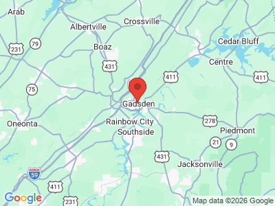
 Etowah County Map
Comprising approximately 542 square miles, Etowah County lies in the northeastern area of the state, wholly within the Cumberland Plateau physiographic section. It is bounded to the east by Cherokee County, to the south by Calhoun and St. Clair Counties, to the west by Blount and Marshall Counties, and to the north by DeKalb County.
Etowah County Map
Comprising approximately 542 square miles, Etowah County lies in the northeastern area of the state, wholly within the Cumberland Plateau physiographic section. It is bounded to the east by Cherokee County, to the south by Calhoun and St. Clair Counties, to the west by Blount and Marshall Counties, and to the north by DeKalb County.
The Coosa River runs north to south through the eastern half of the county, and two of its tributaries, Black and Big Wills creeks, intersect the area. In 1966, Alabama Power constructed H. Neely Henry Dam on the Coosa River, creating the H. Neely Henry Lake, which covers the southern tip of Etowah County. In addition, both the Sand Mountain and Lookout Mountain ranges are located in the county. Interstate 59 runs north-south through the center of the county, and U.S.11 and U.S. 411 parallel the same route. U.S. 278 runs east-west through the center of the county, and U.S. 431 runs north-south. Gadsden Municipal Airport is the county's only public airport.
Events and Places of Interest
 Silver Lakes Short Course
Gadsden is home to Noccalula Falls, a spectacular 90-foot waterfall. Every August, the World's Longest Yard Sale begins in Gadsden and in Alabama runs along the scenic Lookout Mountain Parkway. The three-day event attracts thousands of shoppers and vendors to the area. The area also features Silver Lakes, a course on the famed Robert Trent Jones Golf Trail. Lake H. Neely Henry features some of the area's best fishing, including crappie and largemouth, spotted, and striped bass. The Etowah Heritage Museum hosts exhibits relating to county history, a research library, and a heritage tree park.
Silver Lakes Short Course
Gadsden is home to Noccalula Falls, a spectacular 90-foot waterfall. Every August, the World's Longest Yard Sale begins in Gadsden and in Alabama runs along the scenic Lookout Mountain Parkway. The three-day event attracts thousands of shoppers and vendors to the area. The area also features Silver Lakes, a course on the famed Robert Trent Jones Golf Trail. Lake H. Neely Henry features some of the area's best fishing, including crappie and largemouth, spotted, and striped bass. The Etowah Heritage Museum hosts exhibits relating to county history, a research library, and a heritage tree park.
Additional Resources
- Etowah County Centennial Commission. A History of Etowah County, Alabama. Birmingham: Roberts and Son, 1968.
- Heritage of Etowah County, Alabama. Clanton, Ala.: Heritage Publishing Consultants, Inc., 1999.
External Links
- Etowah County
- Etowah County Schools
- City of Gadsden
- City of Rainbow City
- City of Attalla
- City of Hokes Bluff
- City of Glencoe
- City of Southside
- National Register of Historic Places: Etowah County
- Gadsden-Etowah County Chamber of Commerce
- Gadsden State Community College
- Robert Trent Jones Golf Trail: Silver Lakes
- Noccalula Falls Park
- World's Longest Yard Sale
- H. Neely Henry Lake
- Visit North Alabama