Escambia County
 Little River State Forest
Located in south Alabama on the Florida border, Escambia County is home to portions of the Conecuh National Forest and the Poarch Creek Indian Reservation, the only recognized Native American group in the state of Alabama. The county is governed by an elected five-member commission and includes five incorporated communities. The name likely came from the Creek word for "clear water" or the Choctaw word for "canebrake."
Little River State Forest
Located in south Alabama on the Florida border, Escambia County is home to portions of the Conecuh National Forest and the Poarch Creek Indian Reservation, the only recognized Native American group in the state of Alabama. The county is governed by an elected five-member commission and includes five incorporated communities. The name likely came from the Creek word for "clear water" or the Choctaw word for "canebrake."
- Founding Date: December 10, 1868
- Area: 951 square miles
- Population: 36,775 (2020 Census estimates)
- Major Waterways: Conecuh River
- Major Highways: I-65, U.S. 31, U.S. 29
- County Seat: Brewton
- Largest City: Atmore
History
 Escambia County Courthouse
Escambia County was created by an act of the Alabama State Legislature on December 10, 1868, from portions of Baldwin and Conecuh Counties. On July 27, 1813, the Battle of Burnt Corn Creek, one of the more significant battles of the Creek War of 1813-1814, took place in what is now Escambia County. In July 1813, Peter McQueen, a Creek warrior of the Red Stick faction, secured a cache of weapons from the British and Spanish at what is now Pensacola, Florida. U.S. troops ambushed McQueen and the Red Sticks on the banks of Burnt Corn Creek but were then routed by a Red Stick counterattack. The Red Sticks considered the act a declaration of war and retaliated with the infamous Fort Mims Massacre. At the time of the battle, the site was part of Conecuh County; although the actual site has not been located, most sources now place it in Escambia County.
Escambia County Courthouse
Escambia County was created by an act of the Alabama State Legislature on December 10, 1868, from portions of Baldwin and Conecuh Counties. On July 27, 1813, the Battle of Burnt Corn Creek, one of the more significant battles of the Creek War of 1813-1814, took place in what is now Escambia County. In July 1813, Peter McQueen, a Creek warrior of the Red Stick faction, secured a cache of weapons from the British and Spanish at what is now Pensacola, Florida. U.S. troops ambushed McQueen and the Red Sticks on the banks of Burnt Corn Creek but were then routed by a Red Stick counterattack. The Red Sticks considered the act a declaration of war and retaliated with the infamous Fort Mims Massacre. At the time of the battle, the site was part of Conecuh County; although the actual site has not been located, most sources now place it in Escambia County.
 Flomaton Area Railroad Museum
Fort Crawford was established in 1816 to monitor the activities of the Spanish in Florida and defend against increasing conflicts with the Creek Indians. The majority of the Creeks were forcibly removed from their ancestral homeland in the 1830s, with those who remained, centered largely around Atmore, becoming known as the Poarch Creek. The only federally recognized tribe in the state, they continue to live in and around their reservation in Poarch, where they operate a series of casinos. In 1861, the town of Pollard was established at the juncture of the Alabama & Florida and the Mobile & Great Northern railroad lines. It would be named the county seat in 1868. Steamboats once traversed the Conecuh River carrying cargo to and from Pollard. The town was, in its heyday, an important rail center and was a vital Confederate military post during the Civil War. In January 1865, Pollard was the site of a battle between Confederate troops under Gen. James Holt Clanton and a force of federal raiders.
Flomaton Area Railroad Museum
Fort Crawford was established in 1816 to monitor the activities of the Spanish in Florida and defend against increasing conflicts with the Creek Indians. The majority of the Creeks were forcibly removed from their ancestral homeland in the 1830s, with those who remained, centered largely around Atmore, becoming known as the Poarch Creek. The only federally recognized tribe in the state, they continue to live in and around their reservation in Poarch, where they operate a series of casinos. In 1861, the town of Pollard was established at the juncture of the Alabama & Florida and the Mobile & Great Northern railroad lines. It would be named the county seat in 1868. Steamboats once traversed the Conecuh River carrying cargo to and from Pollard. The town was, in its heyday, an important rail center and was a vital Confederate military post during the Civil War. In January 1865, Pollard was the site of a battle between Confederate troops under Gen. James Holt Clanton and a force of federal raiders.
 Old Escambia County Courthouse
The town was later burned. One of the South's greatest train robberies happened near Pollard on September 2, 1890, when the notorious "Robin Hood of Alabama" Rube Burrow forced the engineer to stop the train on the trestle across Big Escambia Creek. Burrows made his getaway but was trailed through Monroe County into Marengo County, where he was killed in a gun battle. The town of Brewton was named the county seat in 1880 after it outpaced Pollard in population and commerce. Brewton is the birthplace of the legend of Railroad Bill. Stories about Railroad Bill, an armed African American vagrant who rode the boxcars between Flomaton and Mobile, surfaced in 1895 along the tracks of the Louisville and Nashville line. The legend of Railroad Bill has been immortalized in song, theater, and fiction.
Old Escambia County Courthouse
The town was later burned. One of the South's greatest train robberies happened near Pollard on September 2, 1890, when the notorious "Robin Hood of Alabama" Rube Burrow forced the engineer to stop the train on the trestle across Big Escambia Creek. Burrows made his getaway but was trailed through Monroe County into Marengo County, where he was killed in a gun battle. The town of Brewton was named the county seat in 1880 after it outpaced Pollard in population and commerce. Brewton is the birthplace of the legend of Railroad Bill. Stories about Railroad Bill, an armed African American vagrant who rode the boxcars between Flomaton and Mobile, surfaced in 1895 along the tracks of the Louisville and Nashville line. The legend of Railroad Bill has been immortalized in song, theater, and fiction.
Major Cities and Demographics
According to 2020 Census estimates, the population of Escambia County was 36,775. Approximately 61.9 percent of respondents identified themselves as white, 32.0 percent as African American, 3.8 percent as Native American, 2.4 percent as Hispanic, 1.5 percent as two or more races, 0.3 percent as Asian, and 0.1 percent as Native Hawaiian and Other Pacific Islander. The county seat, Brewton, had a population of 5,210. Other population centers include Atmore, East Brewton, Flomaton, Riverview, and Pollard. The median household income was $35,558, compared with $52,035 for the state as a whole, and the per capita income was $18,587, compared with $28,934 for the state.
Economy
 Dairy Cattle
For most of the twentieth century, timber has been the dominant industry in the county, and Swift Lumber Company remains one of the largest employers in the area. During the late nineteenth and early twentieth century, turpentine was a major economic driver in the region. For many years, Vanity Fair lingerie operated a manufacturing plant in the city of Atmore, but it closed in the late 1990s. In 1952, oil was discovered in the town of Pollard.
Dairy Cattle
For most of the twentieth century, timber has been the dominant industry in the county, and Swift Lumber Company remains one of the largest employers in the area. During the late nineteenth and early twentieth century, turpentine was a major economic driver in the region. For many years, Vanity Fair lingerie operated a manufacturing plant in the city of Atmore, but it closed in the late 1990s. In 1952, oil was discovered in the town of Pollard.
Employment
According to 2020 Census estimates, the workforce in Escambia County was divided among the following industrial categories:
- Educational services, and health care and social assistance (19.5 percent)
- Manufacturing (15.3 percent)
- Retail trade (14.4 percent)
- Arts, entertainment, recreation, and accommodation and food services (11.1 percent)
- Other services, except public administration (8.8 percent)
- Public administration (8.4 percent)
- Construction (6.4 percent)
- Professional, scientific, management, and administrative and waste management services (5.6 percent)
- Transportation and warehousing, and utilities (4.5 percent)
- Agriculture, forestry, fishing and hunting, and extractive (2.8 percent)
- Finance and insurance, and real estate, rental, and leasing (2.4 percent)
- Wholesale trade (1.9 percent)
- Information (0.8 percent)
Education
The Escambia County School system oversees 14 schools, and the Brewton City school system has three schools. Coastal Alabama Community College operates campuses in Atmore and Brewton.
Geography
 Escambia County Map
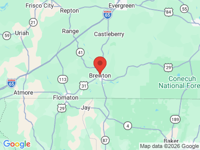
Escambia County encompasses approximately 951 square miles in south Alabama, within the East Gulf Coastal Plain physiographic section. It is bounded to the east by Covington County, to the south by Escambia County, Florida, to the west by Baldwin and Monroe Counties, and to the north by Conecuh County. A portion of Conecuh National Forest lies in the southeast corner of the county. The Conecuh River flows southwest through the eastern half of the county, as do several of its tributaries: Burnt Corn, Murder, Cedar, and Little and Big Escambia Creeks. Interstate 65 runs north-south in the western part of the county, and U.S. 31 and U.S 29 run east-west through the eastern and southern half of the county.
Escambia County Map
Escambia County encompasses approximately 951 square miles in south Alabama, within the East Gulf Coastal Plain physiographic section. It is bounded to the east by Covington County, to the south by Escambia County, Florida, to the west by Baldwin and Monroe Counties, and to the north by Conecuh County. A portion of Conecuh National Forest lies in the southeast corner of the county. The Conecuh River flows southwest through the eastern half of the county, as do several of its tributaries: Burnt Corn, Murder, Cedar, and Little and Big Escambia Creeks. Interstate 65 runs north-south in the western part of the county, and U.S. 31 and U.S 29 run east-west through the eastern and southern half of the county.
Events and Places of Interest
 Poarch Creek Indians Museum
Atmore is home to the Poarch Band Creek Indian Reservation, which offers casino gambling and operates the Poarch Creek Indians Museum. Every November, the reservation hosts the Poarch Creek Band Indian Pow Wow. Every summer, the town of Brewton hosts its annual Blueberry Festival at Burnt Corn Creek Park. The Thomas E. McMillan Museum, located on the Brewton campus of Coastal Alabama Community College, includes displays relating to the culture, archaeology, and history of Escambia County. Little River State Forest offers canoeing, bird watching, swimming, and fishing and is one of the few sites in the state that offers opportunities for disabled hunters.
Poarch Creek Indians Museum
Atmore is home to the Poarch Band Creek Indian Reservation, which offers casino gambling and operates the Poarch Creek Indians Museum. Every November, the reservation hosts the Poarch Creek Band Indian Pow Wow. Every summer, the town of Brewton hosts its annual Blueberry Festival at Burnt Corn Creek Park. The Thomas E. McMillan Museum, located on the Brewton campus of Coastal Alabama Community College, includes displays relating to the culture, archaeology, and history of Escambia County. Little River State Forest offers canoeing, bird watching, swimming, and fishing and is one of the few sites in the state that offers opportunities for disabled hunters.
Additional Resources
- Heritage of Escambia County, Alabama. Clanton, Ala.: Heritage Publishing Consultants, Inc., 2002.
External Links
- Escambia County
- Escambia County Schools
- City of Atmore
- City of Brewton
- City of East Brewton
- Town of Pollard
- Atmore Area Chamber of Commerce
- National Register of Historic Places: Escambia County
- Coastal Alabama Community College
- Poarch Band of Creek Indians
- Poarch Creek Indians Museum
- Little River State Forest