Choctaw County
 Choctaw County Courthouse
Once an area of extensive paper and petroleum industries, Choctaw County is located in southwestern Alabama. The Choctaw National Wildlife Refuge, located near Gilbertown, is an important resting place for migrating birds and provides habitat for a number of Alabama animals. The county is governed by an elected four-member commission and includes seven incorporated communities.
Choctaw County Courthouse
Once an area of extensive paper and petroleum industries, Choctaw County is located in southwestern Alabama. The Choctaw National Wildlife Refuge, located near Gilbertown, is an important resting place for migrating birds and provides habitat for a number of Alabama animals. The county is governed by an elected four-member commission and includes seven incorporated communities.
- Founding Date: December 29, 1847
- Area: 909 square miles
- Population: 12,755 (2020 Census estimate)
- Major Waterways: Tombigbee River
- Major Highways: U.S. 84
- County seat: Butler
- Largest City: Butler
History
 Pushmataha
Choctaw County was created by an act of the Alabama State Legislature on December 29, 1847, from land formerly within the Choctaw Nation. Located in the southwestern part of the state, the county was named for the Choctaw Indians, some of whom had settlements near the present-day town of Pushmataha, named for the noted Choctaw chief. In the 1890s, Choctaw County received national media attention for what became known as the Sims War, which erupted after Robert Sims, a Confederate war veteran turned preacher, amassed a following of 100 parishioners and declared he and his followers owed no allegiance to an earthly government, should not pay taxes, and had the freedom to make and distribute whiskey. In 1891, U.S. marshals charged Sims and his followers with moonshining and put out a warrant for his arrest. In the ensuing months, skirmishes involving the marshals, a local posse, and Sims followers resulted in several deaths. Sims and a number of his men were eventually captured and hanged by a mob.
Pushmataha
Choctaw County was created by an act of the Alabama State Legislature on December 29, 1847, from land formerly within the Choctaw Nation. Located in the southwestern part of the state, the county was named for the Choctaw Indians, some of whom had settlements near the present-day town of Pushmataha, named for the noted Choctaw chief. In the 1890s, Choctaw County received national media attention for what became known as the Sims War, which erupted after Robert Sims, a Confederate war veteran turned preacher, amassed a following of 100 parishioners and declared he and his followers owed no allegiance to an earthly government, should not pay taxes, and had the freedom to make and distribute whiskey. In 1891, U.S. marshals charged Sims and his followers with moonshining and put out a warrant for his arrest. In the ensuing months, skirmishes involving the marshals, a local posse, and Sims followers resulted in several deaths. Sims and a number of his men were eventually captured and hanged by a mob.
Major Cities and Demographics
According to 2020 Census estimates, Choctaw County recorded a population of 12,755. Approximately 56.9 percent of respondents identified themselves as white, 42.3 percent as African American, 0.5 percent as Hispanic, 0.5 as two or more races, 0.2 percent as Asian, and 0.1 percent as Native American. The county seat, Butler, had a population of 2,902. Other population centers in the county include Lisman, Silas, Needham, Pennington, Toxey, and Gilbertown. The median household income was $36,634, compared with $52,035 for the state as a whole, and the per capita income was $23,292, compared with $28,934 for the state as a whole.
Economy

Early settlers in Choctaw County produced cotton and other agricultural goods that they floated down the Tombigbee River to Mobile. The forestry industry has been the economic backbone of the county since its creation in 1847. In 1912, the railroad came to the county, reducing the reliance on water traffic and remained an important commercial transport method until the 1980s.
On January 2, 1944, the state of Alabama granted Hunt Oil Company a permit to drill near Gilbertown in Choctaw County. Drilling commenced on January 10, 1944, and was completed approximately one month later. The discovery of oil led to the creation of the State Oil and Gas Board of Alabama in 1945 and to the development and growth of the petroleum industry in the state. In the mid-twentieth century, clothing factories were constructed in Silas, Toxey, and Butler, and Marathon Paper Company constructed a paper mill in the town of Naheola. By the 1990s, however, the railroad had closed and the clothing factories had moved their operations to other countries.
Employment
According to 2020 Census estimates, the workforce in Choctaw County was divided among the following industrial categories:
- Educational services, and health care and social assistance (24.3 percent)
- Manufacturing (16.7 percent)
- Retail trade (14.7 percent)
- Construction (8.5 percent)
- Agriculture, forestry, fishing and hunting, and extractive (8.4 percent)
- Arts, entertainment, and recreation, and accommodation and food services (6.1 percent)
- Transportation and warehousing, and utilities (4.5 percent)
- Other services, except public administration (3.9 percent)
- Public administration (3.9 percent)
- Professional, scientific, management, administrative and waste management services (3.6 percent)
- Finance and insurance, and real estate, rental, and leasing (3.1 percent)
- Wholesale trade (2.3 percent)
- Information (0.8 percent)
Education
The Choctaw County School System oversees eight schools. In addition, there are two private schools. Coastal Alabama Community College maintains a campus in Gilbertown.
Geography
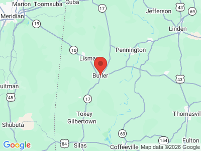
 Choctaw County Map
Comprising approximately 909 square miles, Choctaw County lies in the southwestern area of the state wholly within the Coastal Plain physiographic section. It is bounded to the north by Sumter County, to the east by Marengo and Clarke Counties, to the south by Washington County, and to the west by the state of Mississippi.
Choctaw County Map
Comprising approximately 909 square miles, Choctaw County lies in the southwestern area of the state wholly within the Coastal Plain physiographic section. It is bounded to the north by Sumter County, to the east by Marengo and Clarke Counties, to the south by Washington County, and to the west by the state of Mississippi.
The Tombigbee River flows along the eastern edge of the county, and several of its tributaries, including Wahalak, Big Tallawampa, and Turkey creeks, cross the area. US 84 runs east-west in the southern part of the county, and State Highway 17 runs north-south through the center of the county. Butler-Choctaw County Airport is the county's only public airport.
Events and Places of Interest
 Choctaw National Wildlife Refuge
Choctaw County is home to the Choctaw County Heritage Festival, an annual event held every Memorial Day weekend. The Choctaw County Historical Museum in downtown Gilbertown includes exhibits on Choctaw County's heritage, as well as a log structure that served as the first county courthouse, a country store, and a large outbuilding housing antique farm equipment. The county is also home to Choctaw National Wildlife Refuge, located along the Tombigbee River. The refuge, which includes nearly 4,500 acres, is home to alligators, numerous bird species, beavers, deer, turkey, raccoon, and several endangered or threatened species including bald eagles and wood storks. It is an important stopover for migrating waterfowl. The Old Naheola Bridge, which crosses the Tombigbee River, was built in 1934 and until it closed in 2000 was one of only two bridges in the world that carried rail and automobile traffic on the same road.
Choctaw National Wildlife Refuge
Choctaw County is home to the Choctaw County Heritage Festival, an annual event held every Memorial Day weekend. The Choctaw County Historical Museum in downtown Gilbertown includes exhibits on Choctaw County's heritage, as well as a log structure that served as the first county courthouse, a country store, and a large outbuilding housing antique farm equipment. The county is also home to Choctaw National Wildlife Refuge, located along the Tombigbee River. The refuge, which includes nearly 4,500 acres, is home to alligators, numerous bird species, beavers, deer, turkey, raccoon, and several endangered or threatened species including bald eagles and wood storks. It is an important stopover for migrating waterfowl. The Old Naheola Bridge, which crosses the Tombigbee River, was built in 1934 and until it closed in 2000 was one of only two bridges in the world that carried rail and automobile traffic on the same road.
Additional Resources
- Heritage of Choctaw County, Alabama. Clanton, Ala.: Heritage Publishing Consultants, Inc., 2001.
- Doggette, Edith. The Sims War. Huntsville, Ala.: Strode Publishers, 1982.