Chilton County
 Clanton Water Tower
Located in central Alabama, Chilton County is renowned for its bountiful peach industry. Over 80 percent of Alabama's peach crop comes from the county. Since 1947, the county has sponsored the Chilton County Peach festival. In addition, the town boasts a peach-shaped water tower to honor the county's famous product. The county is governed by an elected seven-member commission.
Clanton Water Tower
Located in central Alabama, Chilton County is renowned for its bountiful peach industry. Over 80 percent of Alabama's peach crop comes from the county. Since 1947, the county has sponsored the Chilton County Peach festival. In addition, the town boasts a peach-shaped water tower to honor the county's famous product. The county is governed by an elected seven-member commission.
- Founding Date: December 30, 1868
- Area: 695 square miles
- Population: 44,147 (2020 Census estimate)
- Major Waterways: Coosa River
- Major Highways: I-65, U.S. 82, U.S. 31
- County Seat: Clanton
- Largest City: Clanton
History
 William P. Chilton
Chilton County was created by an act of the Alabama State Legislature on December 30, 1868, from land taken from Autauga, Bibb, Perry, and Shelby Counties. The county was originally named Baker County for Alfred Baker, credited as the founder of the town of Clanton. After the Civil War, Baker served as the first mayor of the town and came into conflict with townspeople after cooperating with local Republican politicians. On December 17, 1874, citizens of Clanton voted to change the name of their county to Chilton to honor William P. Chilton, chief justice of the Alabama Supreme Court and a member of the provisional and regular Congress of the Confederacy.
William P. Chilton
Chilton County was created by an act of the Alabama State Legislature on December 30, 1868, from land taken from Autauga, Bibb, Perry, and Shelby Counties. The county was originally named Baker County for Alfred Baker, credited as the founder of the town of Clanton. After the Civil War, Baker served as the first mayor of the town and came into conflict with townspeople after cooperating with local Republican politicians. On December 17, 1874, citizens of Clanton voted to change the name of their county to Chilton to honor William P. Chilton, chief justice of the Alabama Supreme Court and a member of the provisional and regular Congress of the Confederacy.
In 1902, Montgomery lawyer and Civil War veteran Jefferson Manly Faulkner donated 80 acres of land in southeastern Chilton County as the site for the Alabama Confederate Soldiers Home. The retirement community consisted of a 22-building complex that included a 25-bed hospital. At its peak, the home housed more than 100 people. The area now serves as Confederate Memorial Park. In post-World War II years, Chilton County emerged as the principle peach-growing area in the state, a status it continues to hold. After a particularly large crop, the town of Thorsby held the first Peach Festival in 1947. The festival moved to Clanton in 1952, where it continues to be celebrated.
Major Cities and Demographics
According to 2020 Census estimates, Chilton County recorded a population of 44,147. Approximately 82.1 percent of the respondents identified themselves as white, 9.7 percent as African American, 7.8 percent as Hispanic, 3.1 percent as two or more races, 1.1 percent as Native American, and 0.4 percent as Asian. The county seat, Clanton, had an estimated population of 8,719. Other significant population centers in the county include Jemison, Thorsby, and Maplesville. The median household income for Chilton County was $52,141, compared with $52,035 for the rest of the state, and the per capita income was $25,894, compared with $28,934 for the state as a whole.
Economy
 Construction of Lay Dam
Since the late nineteenth century, Chilton County's most profitable industry has been timber. The county received a boost to its economy in 1914 and 1922 when Alabama Power built its first two hydroelectric plants, Lay Dam and Mitchell Dam, on the Coosa River. Peach production remains an important industry in Chilton County, but the area is also known for other fruit and vegetable crops, including strawberries, watermelons, and tomatoes. Cattle, poultry, corn, and cotton are also important economically. The Thorsby Nursery was established in 1937 by the U.S. Department of Agriculture to develop new commercial plants. In 1969, Clanton mayor F. B. Clark established the Possum Growers and Breeders Association in an ill-fated attempt to raise the North American marsupials for meat.
Construction of Lay Dam
Since the late nineteenth century, Chilton County's most profitable industry has been timber. The county received a boost to its economy in 1914 and 1922 when Alabama Power built its first two hydroelectric plants, Lay Dam and Mitchell Dam, on the Coosa River. Peach production remains an important industry in Chilton County, but the area is also known for other fruit and vegetable crops, including strawberries, watermelons, and tomatoes. Cattle, poultry, corn, and cotton are also important economically. The Thorsby Nursery was established in 1937 by the U.S. Department of Agriculture to develop new commercial plants. In 1969, Clanton mayor F. B. Clark established the Possum Growers and Breeders Association in an ill-fated attempt to raise the North American marsupials for meat.
Employment
According to 2020 Census estimates, the workforce in Chilton County was divided among the following industrial categories:
- Educational services, and health care and social assistance (16.2 percent)
- Construction (14.8 percent)
- Manufacturing (14.5 percent)
- Retail trade (13.2 percent)
- Finance and insurance, and real estate, rental, and leasing (7.2 percent)
- Transportation and warehousing, and utilities (6.5 percent)
- Other services, except public administration (5.9 percent)
- Professional, scientific, management, administrative and waste management services (5.7 percent)
- Public administration (4.9 percent)
- Arts, entertainment, and recreation, and accommodation and food services (4.3 percent)
- Wholesale trade (3.7 percent)
- Agriculture, forestry, fishing and hunting, and extractive (2.2 percent)
- Information (0.7 percent)
Education
The Chilton County School System oversees 12 schools. In addition, the county contains two private schools. George Wallace Community College maintains a campus in Clanton.
Geography
 Chilton County Map
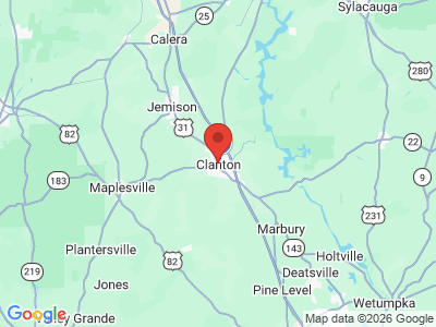
Comprising approximately 695 square miles, Chilton County lies in the central area of the state, almost wholly within the Coastal Plain physiographic section. It is bounded to the north by Shelby County, to the east by Coosa and Elmore Counties, to the south by Autauga and Dallas Counties, and to the west by Perry and Bibb Counties. Part of the southwest corner of the county lies within the Talladega National Forest.
Chilton County Map
Comprising approximately 695 square miles, Chilton County lies in the central area of the state, almost wholly within the Coastal Plain physiographic section. It is bounded to the north by Shelby County, to the east by Coosa and Elmore Counties, to the south by Autauga and Dallas Counties, and to the west by Perry and Bibb Counties. Part of the southwest corner of the county lies within the Talladega National Forest.
The Coosa River runs along the eastern edge of the county, and its tributary, Waxahatchee Creek, crosses the area. In 1914 and 1922, Alabama Power built two dams on the Coosa River, creating Lay Lake and Mitchell Lake. Interstate 65 is Chilton County's major transportation route, running north-south through the center of the county. Gragg-Wade Field Airport is the county's only public airport.
Events and Places of Interest
 Old Southern Depot
As the state's largest commercial producer of peaches, Chilton County is host to the annual Chilton County Peach Festival, which includes a parade, beauty pageants, a peach cook-off, and an auction hosted by the local Lion's Club. Lay Lake and Lake Mitchell, along the Coosa River, offer abundant fishing for spotted and large-mouth bass, crappie, bream, and walleye. The Talladega National Forest, located in the southwestern part of the county, offers hiking trails and several scenic views. Water Course, created by Alabama Power, is an interactive educational center focused on the state's water resources and environment.
Old Southern Depot
As the state's largest commercial producer of peaches, Chilton County is host to the annual Chilton County Peach Festival, which includes a parade, beauty pageants, a peach cook-off, and an auction hosted by the local Lion's Club. Lay Lake and Lake Mitchell, along the Coosa River, offer abundant fishing for spotted and large-mouth bass, crappie, bream, and walleye. The Talladega National Forest, located in the southwestern part of the county, offers hiking trails and several scenic views. Water Course, created by Alabama Power, is an interactive educational center focused on the state's water resources and environment.
The Confederate Memorial Park, located in the southern part of the county, is the historic site of Alabama's only home for Confederate veterans. It includes two cemeteries and a museum that houses Civil War uniforms, weapons, and equipment, plus many relics from the Alabama Confederate Soldiers' Home. The historic Old Southern Depot (1912) in Maplesville houses a history museum dedicated to the town as well as a senior center. The former resort town of Verbena is listed on the National Register of Historic Places, as is the Walker-Klinner Farm in Maplesville, the Old Stage Coach Inn (ca. 1835) in Plantersville, and the Gragg Field Historic District in Clanton, and a number of other structures in the county.
Additional Resources
- Heritage of Chilton County. Clanton, Ala.: Heritage Publishing Consultants Inc., 2000.
- Wyatt, Thomas Eugene. Chilton County and Her People: History of Chilton County. Montevallo, Ala.: Times Printing Company, 1970.