Bibb County
 Adelaide E. Mahan
Located in central Alabama and bordered by many Black Belt counties, Bibb County is known for its recreational opportunities on the Cahaba River and in the Talladega National Forest. During the nineteenth century, Bibb County was a noted iron, coal, and lumber center. Nationally renowned Miller's Pottery is located in Brent. Poet Minnie Bruce Pratt was raised in Centreville, and painter Adelaide Mahan was raised in Brierfield. Birmingham Black Barons all-star George "Mule" Suttles was born and raised in the now-abandoned town of Blocton. The county is governed by an elected five-member commission and includes four incorporated communities each governed by a mayor and city council. Medal of Honor recipient Ross Franklin Gray was raised in Bibb County and is honored on the Wall of Fame at the board of education headquarters.
Adelaide E. Mahan
Located in central Alabama and bordered by many Black Belt counties, Bibb County is known for its recreational opportunities on the Cahaba River and in the Talladega National Forest. During the nineteenth century, Bibb County was a noted iron, coal, and lumber center. Nationally renowned Miller's Pottery is located in Brent. Poet Minnie Bruce Pratt was raised in Centreville, and painter Adelaide Mahan was raised in Brierfield. Birmingham Black Barons all-star George "Mule" Suttles was born and raised in the now-abandoned town of Blocton. The county is governed by an elected five-member commission and includes four incorporated communities each governed by a mayor and city council. Medal of Honor recipient Ross Franklin Gray was raised in Bibb County and is honored on the Wall of Fame at the board of education headquarters.
- Founding Date: February 7, 1818
- Area: 625 square miles
- Population: 22,293 (2020 Census estimate)
- Major Waterways: Cahaba River, Little Cahaba River
- Major Highways: U.S. 82
- County Seat: Centreville
- Largest City: Brent
History
Bibb County was created through an act of the Alabama Territorial Legislature on February 7, 1818, a year before Alabama became a state. Originally called Cahaba County, for the river that runs through it, the county was renamed Bibb County in 1820 to honor of the first governor of Alabama, William Wyatt Bibb. Before settlers moved to the area, it was populated by the Creeks of the Upper Towns, who lived along the banks of the Cahaba and its tributaries. In 1815, non-Indian squatters began moving into the area, and Centreville was made the county seat of government.
 Bibb Furnace at Brierfield Ironworks
Bibb County was extremely rich in ore, coal, clay, and timber, and during the early nineteenth century, local entrepreneurs established several small iron forges in the north and northeastern areas of the county. Oxmoor Furnace in Blocton was the first to produce pig iron in the state. By the 1850s, Bibb County ranked third in the state in iron production, which made the region extremely valuable to the Confederacy during the Civil War. Brierfield Ironworks was established in 1861 and purchased by the Confederate government two years later to produce iron for military use; it was later burned by U.S. Army troops under the command of Gen. James H. Wilson. After the Civil War, Bibb County experienced significant economic and social turmoil, as almost half the population in 1865 consisted of former slaves. The Reconstruction years were characterized by increasing violence against blacks, increasing poverty, and lawlessness.
Bibb Furnace at Brierfield Ironworks
Bibb County was extremely rich in ore, coal, clay, and timber, and during the early nineteenth century, local entrepreneurs established several small iron forges in the north and northeastern areas of the county. Oxmoor Furnace in Blocton was the first to produce pig iron in the state. By the 1850s, Bibb County ranked third in the state in iron production, which made the region extremely valuable to the Confederacy during the Civil War. Brierfield Ironworks was established in 1861 and purchased by the Confederate government two years later to produce iron for military use; it was later burned by U.S. Army troops under the command of Gen. James H. Wilson. After the Civil War, Bibb County experienced significant economic and social turmoil, as almost half the population in 1865 consisted of former slaves. The Reconstruction years were characterized by increasing violence against blacks, increasing poverty, and lawlessness.
 Bibb County Courthouse
In the late nineteenth century, the area experienced a boom in the lumber and coal mining industries, and a number of immigrant families from Belgium, Italy, Austria, Hungary, and Bulgaria moved to the area. Dangerous conditions in the mines drew workers'-rights advocates from the United Mine Workers, who led Bibb County miners in strikes in 1894, 1904, 1908, and 1920. The plight of the miners attracted the attention of national labor leader Eugene V. Debs, who spoke to crowds in Blocton in 1896. The area received an economic boost in 1898 when a branch of the Mobile and Ohio Railroad was completed in the southeastern part of the county.
Bibb County Courthouse
In the late nineteenth century, the area experienced a boom in the lumber and coal mining industries, and a number of immigrant families from Belgium, Italy, Austria, Hungary, and Bulgaria moved to the area. Dangerous conditions in the mines drew workers'-rights advocates from the United Mine Workers, who led Bibb County miners in strikes in 1894, 1904, 1908, and 1920. The plight of the miners attracted the attention of national labor leader Eugene V. Debs, who spoke to crowds in Blocton in 1896. The area received an economic boost in 1898 when a branch of the Mobile and Ohio Railroad was completed in the southeastern part of the county.
On April 27, 2011, a massive storm, causing numerous powerful tornadoes, struck the southeastern United States. More than 250 people were killed in Alabama, including one person in Brent.
Major Cities and Demographics
According to 2020 Census estimates, Bibb County recorded a population of 22,293. Approximately 76.6 percent of respondents identified themselves as white, 22.5 percent as African American, 2.7 percent as Hispanic, 0.5 percent as two or more races, 0.3 as Asian, and 0.1 percent as Native American. The county seat, Centreville, recorded a population of 2,627, and the largest city, Brent, recorded a population of 4,768. Other towns include Woodstock and West Blocton. The median household income in Bibb County was $51,721, as compared with $52,035 for the state as a whole, and the per capita income was $22,626, compared with $28,934 for the state as a whole.
Economy
 Old West Blocton Bank Building
During the nineteenth century, farming and iron manufacturing were the prevailing industries in Bibb County. Abundant mineral deposits in the northern section of the county made it an important center of manufacturing, and the Confederacy purchased Brierfield Iron works in 1863 to aid the southern war effort. After it was burned by federal troops in 1865, Josiah Gorgas became one of many who tried in vain to revive the iron industry in the county. By 1900, the booming industries of Birmingham eclipsed the area. Given the county's heavily forested areas, which include pine, especially loblolly, as well as oak, hickory, walnut, tulip poplar, gum, cedar, and dogwood, the lumber business rapidly became highly profitable.
Old West Blocton Bank Building
During the nineteenth century, farming and iron manufacturing were the prevailing industries in Bibb County. Abundant mineral deposits in the northern section of the county made it an important center of manufacturing, and the Confederacy purchased Brierfield Iron works in 1863 to aid the southern war effort. After it was burned by federal troops in 1865, Josiah Gorgas became one of many who tried in vain to revive the iron industry in the county. By 1900, the booming industries of Birmingham eclipsed the area. Given the county's heavily forested areas, which include pine, especially loblolly, as well as oak, hickory, walnut, tulip poplar, gum, cedar, and dogwood, the lumber business rapidly became highly profitable.
Most nineteenth-century residents earned their living from agricultural products, including corn, wheat, rye, and especially cotton. In 1860, the county reported production of 8,303 bales of cotton, or approximately three million pounds. Cotton production declined during the post war years, but railroads helped spur the lumber and coal industries, which would become the principal industry in the town in the late-nineteenth and early-twentieth centuries.
Employment
According to 2020 Census estimates, the workforce in present-day Bibb County is divided among the following industrial categories:
- Educational services, and health care and social assistance (22.4 percent)
- Manufacturing (14.6 percent)
- Retail trade (10.8 percent)
- Construction (9.4 percent)
- Other services, except public administration (6.2 percent)
- Transportation and warehousing, and utilities (6.2 percent)
- Professional, scientific, management, administrative, and waste management services (7.0 percent)
- Arts, entertainment, and recreation, and accommodation and food services (3.3 percent)
- Public administration (5.7 percent)
- Finance and insurance, and real estate, rental, and leasing (5.0 percent)
- Agriculture, forestry, fishing and hunting, and extractive (4.7 percent)
- Wholesale trade (3.1 percent)
- Information (1.4 percent)
Education
The Bibb County School System oversees 10 public schools. In addition, the area contains two private schools.
Geography
 Bibb County Map
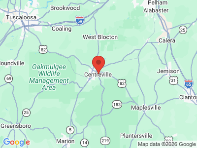
Comprising approximately 625 square miles, Bibb County sits at center of the state. It is bounded to the south by Perry County, to the west by Hale and Tuscaloosa Counties, to the north by Jefferson and Shelby Counties, and to the east by Chilton County. The Cahaba River runs through Bibb County f-rom north to south, and its tributaries, the Little Cahaba, Sixmile Creek, and Shultz Creek, flow through the eastern and western parts of the county. Numerous other creeks intersect its southwestern region. U.S. 82 is Bibb County's major transportation route, running east-west through the southern part of the county. Bibb County Airport is the county's only public airport.
Bibb County Map
Comprising approximately 625 square miles, Bibb County sits at center of the state. It is bounded to the south by Perry County, to the west by Hale and Tuscaloosa Counties, to the north by Jefferson and Shelby Counties, and to the east by Chilton County. The Cahaba River runs through Bibb County f-rom north to south, and its tributaries, the Little Cahaba, Sixmile Creek, and Shultz Creek, flow through the eastern and western parts of the county. Numerous other creeks intersect its southwestern region. U.S. 82 is Bibb County's major transportation route, running east-west through the southern part of the county. Bibb County Airport is the county's only public airport.
Events and Places of Interest
 Cahaba Lilies
The proximity of the Cahaba River and the Talladega National Forest make Bibb County a popular recreational destination. Once considered a fisherman's paradise, the Cahaba River is best known for its scenic wildlife and canoeing. Except for a single location in Tennessee, the Alabama croton, one of the rarest shrubs in the United States, grows only along the banks of the Cahaba. The endangered Cahaba lily, found along the Cahaba and Little Cahaba, attracts nature enthusiasts during May and June, its traditional blooming period. Every May, thousands flock to the town of West Blocton, in northern Bibb County, to the Cahaba Lily Festival. Activities include presentations on the lily and other local wildflowers, the crowning of the Cahaba Lily Queen, and canoe and kayak trips along the river to view the lilies in their natural habitat.
Cahaba Lilies
The proximity of the Cahaba River and the Talladega National Forest make Bibb County a popular recreational destination. Once considered a fisherman's paradise, the Cahaba River is best known for its scenic wildlife and canoeing. Except for a single location in Tennessee, the Alabama croton, one of the rarest shrubs in the United States, grows only along the banks of the Cahaba. The endangered Cahaba lily, found along the Cahaba and Little Cahaba, attracts nature enthusiasts during May and June, its traditional blooming period. Every May, thousands flock to the town of West Blocton, in northern Bibb County, to the Cahaba Lily Festival. Activities include presentations on the lily and other local wildflowers, the crowning of the Cahaba Lily Queen, and canoe and kayak trips along the river to view the lilies in their natural habitat.
Talladega National Forest, located in the southern and southwest areas of Bibb County, attracts thousands of hikers and campers. Heavily logged in the early twentieth century, the forest was bought by the federal government in the 1930s and now hosts a diverse ecosystem. Bibb County is home to the Oakmulgee section of the forest, which is characterized by level and moderately sloping, broad ridges with terraced streams. Historic attractions in the county include Brierfield Ironworks Historical State Park, which centers on an iron furnace constructed in 1861 to aid the Confederate war effort.
Additional Resources
- Bibb County Heritage Book Committee. Heritage of Bibb County, Alabama. Clanton, Ala.: Heritage Publishing Consultants, 1998.
- Ellison, Rhoda Coleman. Bibb County, Alabama: The First Hundred Years, 1818-1918. Tuscaloosa: University of Alabama Press, 1984.