Bernard Romans
 Romans Engraving
Surveyor, artist, naturalist, and author Bernard Romans (ca. 1720-ca. 1783) recorded Alabama’s coastline and Mobile Bay, among other areas, in his maps and composed one of the most significant eighteenth-century works on what would become Alabama, A Concise Natural History of East and West Florida (1775). He was also an experienced ship’s captain and a highly regarded participant in the American Revolution who actively worked for American independence.
Romans was born around 1720 in the Netherlands and educated there. In 1757, he arrived in the Americas and was engaged by the British as a merchant seaman and sailed under the British flag as a privateer during the Seven Years’ War. He continued as a merchant after the war, and his extensive travels took him to ports of call from the Caribbean to Canada. When he lost his ship (and fortune) to the treacherous reefs along the Florida cape, Romans retired from the sea and took a position as deputy surveyor of Georgia, where he assisted in the survey of the newly negotiated boundary line between the Creek Nation and Georgia.
 Romans Map Detail
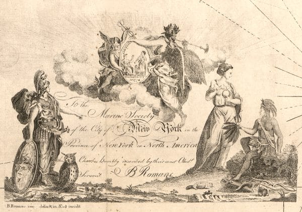
He was appointed by the British Crown in 1768 as the principal deputy surveyor for what was known as the Southern District, which included most of the colonial territory south of Virginia. Romans worked out of East Florida (the Florida peninsula) and made some of the first coastal surveys of the Florida peninsula as well as large land grants made by King George III in East Florida. In 1771, he headed to British West Florida (which included what are now the Florida panhandle and the lower thirds of both present-day Alabama and Mississippi) and assisted John Stuart, superintendent of Indian affairs for the Southern District, in completing a comprehensive map of the southern Indian nations. Romans was assigned to the Chickasaw and Choctaw nations, and fellow surveyor David Taitt undertook the survey of Creek territory. During Romans’ West Florida sojourn, he completed coastal surveys of the area. His work for Stuart was incorporated into a comprehensive map of the South drawn by Joseph Purcell and titled “A map of West Florida part of Et [East] Florida, Georgia and part of So [South] Carolina . . . ,” which is today generally known as the Stuart-Gage map (for John Stuart and Thomas Gage, the British military commander to whom it was presented). The exceptionally detailed and accurate map stands as one of the signal achievements of British cartography from the period and ranks as one of the great early maps of the South and certainly one of the most accurate in regard to the location of Creek, Choctaw, and Chickasaw towns.
 Creek Warrior Sketch
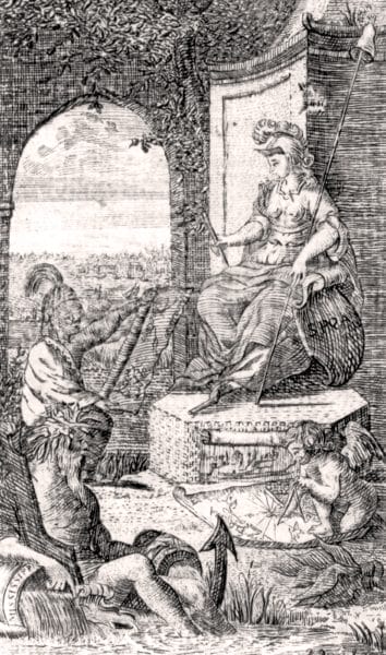
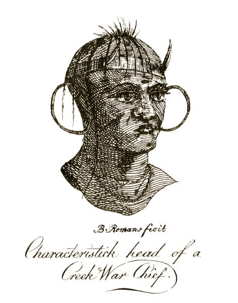
When not involved in surveying and mapping, Romans turned his attention to compiling a natural history of the Floridas, which expanded to include descriptions of key sailing passes through the Florida keys and “advice to mariners” as well as detailed descriptions of the flora and fauna of the British Floridas, accounts of the various Indian tribes, and guidelines for potential emigrants. Romans’s attention to the natural world ultimately won him a government post as West Florida’s official botanist. But by that time, Romans had left the colony for the Northeast, where he pursued publication of his book and diligently worked to procure advance subscribers to help offset the cost of publication. In addition to two oversized maps of the Gulf of Mexico and the Caribbean, the book was also illustrated with a number of engravings depicting “characteristic” scenes of Creek, Chickasaw, and Choctaw Indians and their everyday life.
By this time, the American Revolution had begun, and Romans quickly became actively involved, lending his considerable artistic skills to create patriotic images to aid the American cause. At about the same time that A Concise Natural History finally appeared in print, his illustration of the Battle of Bunker Hill, titled “An Exact View of the Late Battle at Charlestown, June 17th, 1775,” was also being widely printed and sold. The image is considered one of the most important early American engravings and a classic icon of the early revolutionary struggle. Romans also worked to produce maps for the American public and the army and unwittingly created the only American map used by the British, his “A General Map of the Southern British Colonies,” which was incorporated into the American Military Pocket Atlas. The version produced for British cavalry officers was known as the “Holster Atlas.”
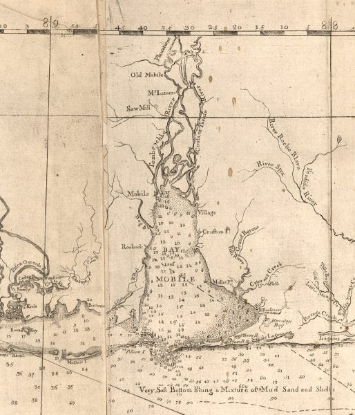 Map of Mobile Bay
Romans also joined in the war as an engineer and a consultant and was chosen by the New York Committee of Safety to fortify the Highlands along the Hudson River in anticipation of a British attack from Canada. Romans then joined the military and served as a captain in the First Pennsylvania Company of Artillery and participated in the campaign against Quebec. He later advised General Horatio Gates on American naval preparation on Lake Champlain. Romans left active service in mid-1778, and although he continued to produce maps for the Americans, he primarily turned his attention to another book project, The Annals of the Troubles in the Netherlands, a history of the Netherlands in which he detailed the struggles of the Dutch against the British. As the war heated up in the South, Romans decided to head there and rejoin the army. Evidence indicates that he was captured by the British navy while en route to South Carolina and was confined in prison in Jamaica until the end of the war. He likely died in 1783 on the return passage after his release at the cessation of hostilities, and family members believed that he was murdered.
Romans was married twice. His first marriage, in 1761 to Mary Wendell of Albany, New York, produced a son, Peter Milo Romans. Mary Romans is believed to have died in childbirth in 1762. Tradition holds that Romans was introduced to his second wife, Elizabeth Whiting, of Wethersfield, Connecticut, by George Washington. The couple married in 1779, and the union produced a son, Hubertus Romans.
Further Reading
- Braund, Kathryn E. Holland. “Bernard Romans: His Life and Times.” In A Concise Natural History of East and West Florida, by Bernard Romans, pp. 1-74. 1775. Reprint, Tuscaloosa: University of Alabama Press, 1999.
- Cumming, William P. The Southeast in Early Maps. 3rd ed. Revised by Louis De Vorsey, Jr. Chapel Hill: University of North Carolina Press, 1998.
- Diamant, Lincoln. Bernard Romans: Forgotten Patriot of the American Revolution, Military Engineer and Cartographer of West Point and the Hudson Valley. Harrison, N.Y.: Harbor Hill Books, 1985.
- Phillips, Philip Lee. Notes on the Life and Works of Bernard Romans. Deland: Florida State Historical Society, 1924.


