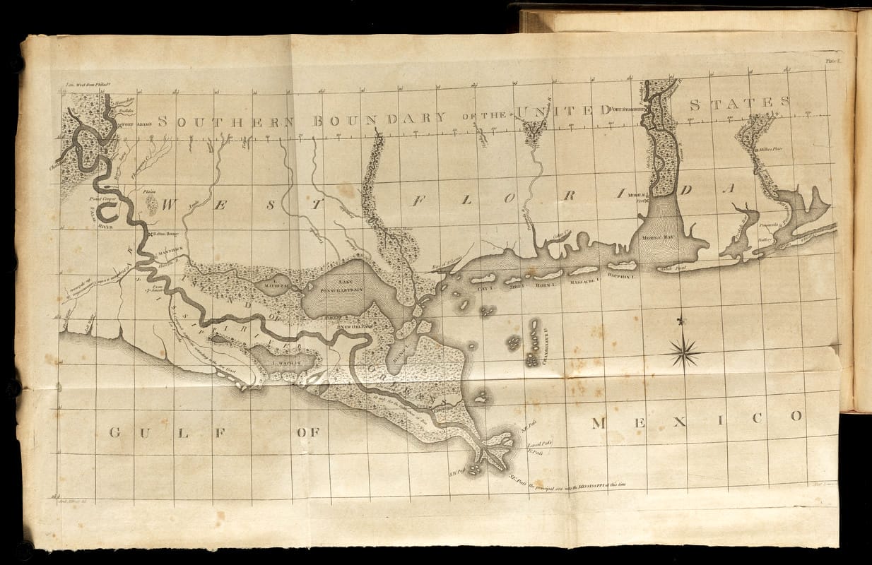
This 1799 map from the The Journal of Andrew Ellicott depicts the region that he measured and surveyed on behalf of the United States to determine its boundary with Spanish West Florida. Ellicott placed the boundary at the 31st Parallel through what are now Mobile and Baldwin Counties in Alabama.