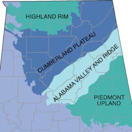
This map shows the drainage system of the Tallapoosa River in the Piedmont Upland Physiographic Section. The river system encompasses some 3,000 square miles and leaves the Piedmont Upland at the fall line, the boundary between this section and the East Gulf Coastal Plain Physiographic Section to the south and west. A series of dams form lakes in the southern half of its range.
Tallapoosa River System
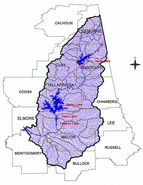
Courtesy of the Alabama Department of Environmental Management
Appears In