Daleville
Daleville is located in southwest Dale County, in the southeast corner of the state. The town is located adjacent to the southern border of Fort Novosel (formerly Fort Rucker), the primary training center for Army Aviation, and is home to the U.S. Army Aviation Museum.
History
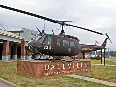 Helo 2 Display in Daleville
Daleville and Dale County were named in honor of Samuel Dale, a frontiersman, soldier, and public servant who participated in the Creek War of 1813-14. The town was established in 1827 as the county seat, as it was at the time in the geographical center of the county; initially it was named Dale Court House. By 1843, as county boundaries changed with the creation of new counties around Dale County, its county seat was moved from Dale Court House to Newton and finally to Ozark. After several name changes, the town adopted Daleville as its official name in 1848.
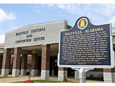 Daleville Cultural and Convention Center
In 1900, a railroad spur ran into the town, and it briefly became a cotton shipping center because of the existence of two cotton gins in the area. A post office was established in 1905, and the first bank was established in 1911. The town voted to incorporate in 1912 but voted to rescind that incorporation four years later.
During the 1930s, the federal government purchased land around Daleville as part of New Deal land conservation efforts. When World War II broke out, the government purchased more land and established an infantry training camp that would form the core of what is now Fort Novosel. Since that time, Daleville’s economic well-being has depended primarily on the fortunes of the fort and its programs. Daleville voted to incorporate again in 1958.
Demographics
According to 2020 Census estimates, Daleville recorded a population of 5,125. Of that number, 60.5 percent identified themselves as white, 28.6 percent as African American, 8.4 percent as Hispanic, 6.0 percent as two or more races, 3.0 percent as Asian, and 1.2 percent as Native American. The town’s median household income was $35,255, and the per capita income was $21,559.
Employment
According to 2020 Census estimates, the workforce in Daleville was divided among the following industrial categories:
- Arts, entertainment, recreation, and accommodation and food services (24.1 percent)
- Retail trade (15.7 percent)
- Manufacturing (13.8 percent)
- Educational services, and health care and social assistance (13.4 percent)
- Transportation and warehousing and utilities (8.8 percent)
- Public administration (6.8 percent)
- Construction (6.5 percent)
- Finance, insurance, and real estate, rental, and leasing (4.4 percent)
- Other services, except public administration (3.9 percent)
- Professional, scientific, management, and administrative and waste management services (1.9 percent)
- Wholesale trade (0.4 percent)
- Information (0.3 percent)
Education
Schools in Daleville are part of the Daleville City School District; the town has one elementary school and one high school.
Transportation
State Highway 85 runs north-south through Daleville, and State Highway 134 runs east-west. U.S. Highway 84 lies less than a mile south of the city, running east-west. Enterprise Municipal Airport is located less than 10 miles to the west.
Events and Places of Interest
Daleville has two parks with tennis courts, walking tracks, softball and baseball fields, and a pavilion and picnic area. The Daleville Community Center offers a basketball gymnasium, outdoor basketball courts, and two baseball fields, as well as meeting rooms.
Further Reading
- Dale County Heritage Book Committee. The Heritage of Dale County, Alabama. Clanton, Ala.: Heritage Publishing Consultants, Inc., 2001.
- McGee, Val. L. Claybank Memories: A History of Dale County, Alabama. Ozark, Ala.: Dale County Historical Society, 1989.
- Watson, Fred S. Forgotten Trails: A History of Dale County, Alabama, 1824-1966. Edited by William R. Snell. Birmingham, Ala.: Banner Press, 1968.
