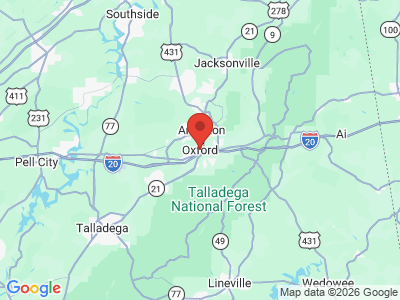
Oxford
Oxford is located in Calhoun County, just south of Anniston in northeast Alabama. It has a mayor/council form of government. Maud McLure Kelly, Alabama's first woman lawyer, was born and raised in Oxford.
History

Prior to non-Indian settlement, the area that currently includes Oxford was inhabited by Creeks of the Abeika towns. Situated just northwest of Cheaha Mountain, Oxford began as a small log-cabin community known as Lick Skillet and became a trade center for cotton farmers. Residents renamed the town Oxford after the British university city, and It was incorporated on February 7, 1852. By 1862, the Alabama and Tennessee River Railroad had established a rail line through the town. Oxford College was established sometime in the 1860s and operated until approximately 1899. In 1909, the college's single building was sold to the city and served as the high school until 1950, when a new school was built on the site.
In 1899, the African American residents of a segregated section of Oxford known as Mooree Quarter petitioned the county government to incorporate as their own town. They were granted that right on April 16 of that year and incorporated as Hobson City, at the time, only the second municipality in the United States governed entirely by African Americans.

Marble Springs, located southeast of the town, became a social and recreational center when a lake was built around it that became known as Oxford Lake in the late 1880s. The site's popularity declined in the 1930s because of the Great Depression, but made a comeback during World War II with the addition of many amusements, including rides, roller skating, and ball fields. The town purchased the lake in 1955 and constructed a civic center nearby in the late 1970s.
Archaeologists have identified several mounds in the area that were built prior to Creek inhabitation of the site. They were part of a regionally important ceremonial center that had been continually occupied by Native Americans until their forced removal in the 1830s. Damage to one of the largest mounds by a developer in the late 2000s received local and national media attention. City officials, state and local archaeologists, state and federal authorities, and representatives of the Muscogee (Creek) Nation have since been working together to determine its significance and how to deal with its remains.
Demographics
According to 2020 Census estimates, Oxford recorded a population of 21,282. Of that number, 74.9 percent of respondents identified themselves as White, 14.3 percent as African American, 7.9 percent as Hispanic, 2.7 percent as two or more races, 2.5 percent as Asian, and 0.2 percent as Native American. The town's median household income was $63,156, and the per capita income was $30,233.
Employment
According to 2020 Census estimates, the workforce in Oxford was divided among the following industrial categories:
- Manufacturing (20.4 percent)
- Educational services and health care and social assistance (19.1 percent)
- Retail trade (11.9 percent)
- Arts, entertainment, and recreation, and accommodation and food services (7.4 percent)
- Professional, scientific, and management, and administrative and waste management services (7.3 percent)
- Public administration (6.5 percent)
- Other services, except public administration (6.0 percent)
- Construction (5.2 percent)
- Transportation and warehousing, and utilities (5.1 percent)
- Finance and insurance, and real estate and rental and leasing (5.0 percent)
- Wholesale trade (3.3 percent)
- Agriculture, forestry, fishing and hunting, and extraction (1.6 percent)
- Information (1.2 percent)
Education
Public education is administered by Oxford City Schools, overseeing four elementary, one middle, and one high school. In addition, there are two religious schools in the city. The closest higher education opportunity is at the Gadsden State Community College Ayers Campus located just to the east of Oxford.
Transportation
Interstate 20, which runs east-west, bisects Oxford. The city also is accessed by U.S. Highway 431 and State Highway 21, which run north-south, and U.S. Highway 78 and State Highway 4, which run east-west.
The Anniston Metropolitan Airport lies just south of Interstate 20. The Norfolk Southern Corporation operates a rail line through Oxford.
Events and Places of Interest

The city holds its annual Oxfordfest on the first Saturday in October; it features arts, crafts, food, and music. Proceeds from the festival go to local charities and organizations. The Davis C. Cooper House (1911), the Coldwater Covered Bridge (1850), located in Oxford Lake Park, and the Oxford Railway Depot (1884) are listed on the National Register of Historic Places. The Blue Spring Mill (ca. 1885), the Calhoun County/Oxford High School Football Stadium (ca. 1932), the Z. H. Clardy House (ca. 1880), the Davis C. Cooper House (ca. 1911), the Gunnells-Wingo House (ca. 1860), and the Patillo House (ca. 1864) are all listed on the Alabama Register of Landmarks and Heritage. Recreational facilities around or near Oxford Lake include a swimming pool, ball fields and batting cages, a special-needs baseball facility, tennis courts, picnic pavilions, a walking track, and the Oxford Civic Center, which has space available for rental. Cider Ridge Golf Club features an 18-hole course constructed on a former apple orchard along Little Hillabee and Choccolocco Creeks. It is owned by the city but has membership options. The city also opened the 1,200-seat Oxford Performing Arts Center in 2013.
Additional Resources
- Stewart, Margaret Estelle. Alabama's Calhoun County. Centre, Ala.: Stewart University Press, 1976.
- Heritage of Calhoun County, Alabama. Clanton, Ala.: Heritage Publishing Consultants, Inc., 1998.