Piedmont Upland Physiographic Section
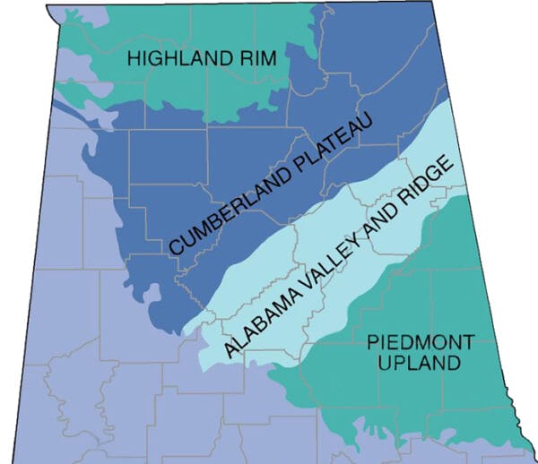 Location of Piedmont Upland Section
The Piedmont Upland section is part of the Piedmont province of the Appalachian Highlands Region. Hereafter called the Piedmont Upland, it is one of Alabama’s five physiographic sections, each of which is recognized by its pattern of relief features and landforms and which differ significantly from those of adjacent sections. It occupies about 9 percent of the state. The Piedmont Upland occurs as a triangular area in east-central Alabama and includes such cities as Ashland in Clay County, Heflin in Cleburne County, and Phenix City in Russell County. It is bordered by the Tennessee Valley and Ridge section of the Valley and Ridge province to the northwest and the East Gulf Coastal Plain to the south. The Piedmont consists of a plateau that slopes from the north, with elevations commonly above 1,000 feet, to the south, where it contacts the Coastal Plain at about 500 feet.
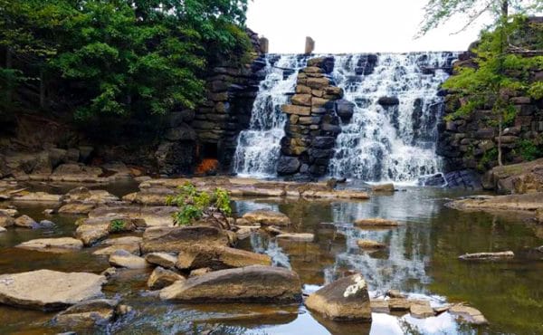 Chewacla State Park
The Piedmont developed on northeast-southwest trending belts of Precambrian to Paleozoic (around 1.0 billion years to about 300 million years in age) metamorphic rocks that are highly deformed and bordered by faults. The most common rock types are slate, phyllite, marble, quartzite, greenstone, schist, amphibolite, and gneiss, some of which are among the oldest rocks in Alabama. Chewacla State Park, located just south of Auburn in Lee County, is in the Southern Piedmont Upland and contains the oldest known rock in Alabama, a gneiss dating from 1.05 billion years ago. A characteristic small-scale feature of the Piedmont is saprolite, or “rotten rock,” which forms where decomposition of the original rocks to depths up to 20 to 40 feet changes the minerals present in rocks but retains their texture and structure.
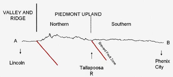 Piedmont Upland Section Topographic Profile
Although described as a plateau, the relatively flat nature of the Piedmont is only obvious in its southern region. The northern part contains many of the highest peaks in the state, including Mt. Cheaha, the state’s highest point at 2,407 feet, and numerous northeast-trending steep-sided ridges. The point at which the Piedmont’s relatively rugged landscape becomes flat serves as a dividing line between the Northern Piedmont Upland district and the Southern Piedmont Upland district. The boundary is the Brevard Fault Zone, which roughly follows the course of the Tallapoosa River in the vicinity of Lake Martin, in Tallapoosa County. In Randolph County, the boundary swings toward the northeast and follows the valley of High Pine Creek, passing just north of Roanoke.
Districts
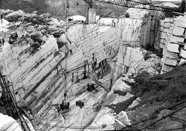 Marble Quarry, 1935
The Piedmont consists of two districts: the Northern Piedmont Upland and the Southern Piedmont Upland. The Northern Piedmont Upland is underlain by slate, quartzite, phyllite, marble, gneiss, and schist, and the rugged nature and high elevations of the northwestern part of the upland are caused by varying rates of erosion of these rock types. The highest elevations and greatest relief (changes in elevation) occur near the northwestern edge of the Northern Piedmont. Erosion-resistant quartzite comprises the high ridges, whereas the flat areas at lower elevations, mainly in the vicinity of Sylacauga, in Talladega County, are underlain by marble, which is extremely susceptible to chemical weathering. The Southern Piedmont Upland is underlain by schist, gneiss, and amphibolite. These rocks resist erosion equally, accounting for the flatness of the area. Rivers have cut valleys up to 200 feet deep in the plateau.
The Tallapoosa River System
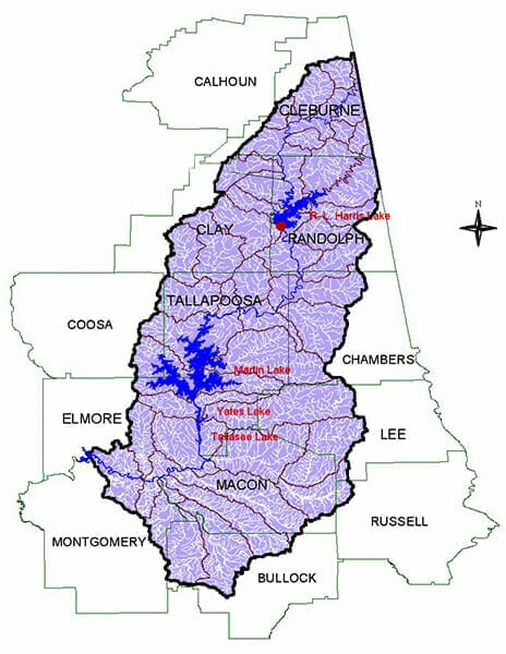 Tallapoosa River System
More than half of the Piedmont is drained by the Tallapoosa River and its tributaries. The main trunk of the system is about 200 miles long, entering the state near Muscadine, in Cleburne County, and leaving the Piedmont at Tallassee, in Tallapoosa County. The system drains about 3,300 square miles. On a regional scale, the Tallapoosa and Little Tallapoosa Rivers are a series of relatively straight segments broken up by abrupt changes in direction. The dominant flow directions are to the southwest, south, and west. The most abrupt change occurs near Belltown, in Cleburne County, where the Tallapoosa turns from the southwest to the south. Floodplains vary from less than 50 feet to more than one mile wide.
At the fall line, the boundary between the Piedmont Upland and the Coastal Plain, the Tallapoosa’s gradient (drop in elevation per mile) increases, and the river flows through rougher terrain. Alabama Power Company constructed four dams along this stretch of the river: Martin Dam (1926), Yates Dam (1928), Thurlow Dam (1930), and Harris Dam (1983), the last being built over rapids 77 miles upstream from Martin Dam.
Natural Resources
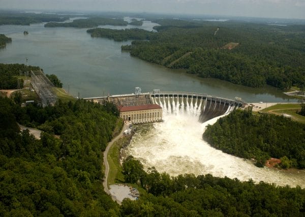 Martin Lake and Dam
Historically, the Piedmont Upland was valued for its mineral resources. Between 1840 and 1934, about 33,000 ounces of gold were extracted from many small workings in the Northern Piedmont and in the Brevard Fault Zone. About one-third of all gold mined in Alabama came from a series of quartz-gold veins found at Hog Mountain, 13 miles north of Alexander City, in Tallapoosa County. Today, no extensive gold-mining operations exist in the state, and no extensive prospecting is presently taking place.
Today, there are several marble quarries near Sylacauga and Auburn. Most of the quarried material is used for crushed stone, but the white Sylacauga marble from the Alabama Marble Company’s quarry is mined in larger blocks, known as dimension stone, and used for architectural purposes.
Further Reading
- Adams, G. I., et al. Geology of Alabama. Geological Survey of Alabama Special Report 14. Tuscaloosa, Ala.: Geological Survey of Alabama, 1926.
- Guthrie, G. M. “The Timing and Techtonic Mechanisms of the Alleghanian Orogeny, Alabama Piedmont.” Geological Society of Alabama Guidbook 33. Tuscaloosa: Geological Society of Alabama, 1995.
- Lacefield, James. Lost Worlds in Alabama Rocks. Revised edition. Tuscaloosa: Alabama Museum of Natural History, 2018.
- Steltenpohl, M. G., et al. “Geology of the Alabama Inner Piedmont Terrane.” Geological Survey of Alabama Bulletin 139. Tuscaloosa: Geological Society of Alabama, 1990.
- Yokal, L. S., et al. “Comparison of the Pine Mountain Block Basement-Cover Sequence with the Lower Cambrian Clastic-Carbonate Sequence of the Talladega Slate Belt.” 46th Annual Meeting Guidebook Geological Society of America, Southeastern Section. Boulder, Colo.: Geological Society of America, 1997.
