Clay County
Located in east-central Alabama, Clay County is home to large portions of the Talladega National Forest. A seat of Jacksonian Democratic politics in the late nineteenth century, the county was one of the strongest advocates of a radical agrarian uprising of the 1890s. The Ashland-Lineville high-school football rivalry was recently named one of the top football rivalries in the nation by USA Today. The county is governed by an elected five-member commission.
- Founding Date: December 7, 1866
- Area: 605 square miles
- Population: 13,285 (2020 Census estimate)
- Major Waterways: Hatchett Creek, Ketchepedrakee Creek, Little Hillabee Creek
- Major Highways: State Route 9, State Route 77, State Route 49
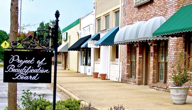
- County Seat: Ashland
- Largest City: Lineville
History
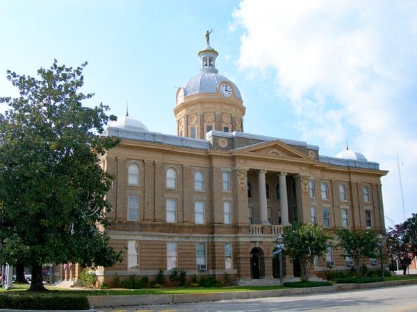 Clay County Courthouse
Clay County was created by an act of the state legislature on December 7, 1866, and was formed from parts of Randolph and Talladega Counties. Named in honor of Henry Clay, a prominent politician from Kentucky, the county lies in what was some of the last lands occupied by the Creek Indians before their removal west in 1832. Given its hilly terrain and lack of rich land, early settlers to the area tended to be poor farmers. During the first half of the nineteenth century, the land was characterized by small farms of less of than 50 acres, with corn being the major crop.
Clay County Courthouse
Clay County was created by an act of the state legislature on December 7, 1866, and was formed from parts of Randolph and Talladega Counties. Named in honor of Henry Clay, a prominent politician from Kentucky, the county lies in what was some of the last lands occupied by the Creek Indians before their removal west in 1832. Given its hilly terrain and lack of rich land, early settlers to the area tended to be poor farmers. During the first half of the nineteenth century, the land was characterized by small farms of less of than 50 acres, with corn being the major crop.
 Sen. Hugo L. Black
During Reconstruction, legislators created new property taxes that forced farmers into indebtedness and tenancy and by the 1880s, Clay County had one of the highest rates of indebted farmers. The Populist movement that swept Alabama during the 1880s and 1890s took firm hold in Clay County, which became known as “the cradle of Alabama populism.” In the county seat of Ashland, Populist Party members published the People’s Party Advocate and threw their support behind the party’s gubernatorial candidate Reuben F. Kolb. As the Populist Party and farming waned, Clay County’s economy switched to mining and manufacturing, as mines, timber firms, and chicken plants moved into the area. The county remains one of the most rural and sparsely populated counties in Alabama. Natives of Clay County include 1920s Ku Klux Klan imperial wizard Hiram Wesley Evans, Supreme Court Justice Hugo L. Black, and Alabama governor Bob Riley.
Sen. Hugo L. Black
During Reconstruction, legislators created new property taxes that forced farmers into indebtedness and tenancy and by the 1880s, Clay County had one of the highest rates of indebted farmers. The Populist movement that swept Alabama during the 1880s and 1890s took firm hold in Clay County, which became known as “the cradle of Alabama populism.” In the county seat of Ashland, Populist Party members published the People’s Party Advocate and threw their support behind the party’s gubernatorial candidate Reuben F. Kolb. As the Populist Party and farming waned, Clay County’s economy switched to mining and manufacturing, as mines, timber firms, and chicken plants moved into the area. The county remains one of the most rural and sparsely populated counties in Alabama. Natives of Clay County include 1920s Ku Klux Klan imperial wizard Hiram Wesley Evans, Supreme Court Justice Hugo L. Black, and Alabama governor Bob Riley.
Major Cities and Demographics
According to 2020 Census estimates, Clay County recorded a population of 13,285. Approximately 83.3 percent of respondents identified themselves as white, 15.3 percent as African American, 3.1 as percent Hispanic, 0.9 percent as two or more races, 0.2 percent as Asian, and 0.2 percent as Native American. The county seat, Ashland, had a population of 1,680. The other significant population center in the county is Lineville. The median household income in Clay County was $42,678, compared with $52,035 for the rest of the state, and the per capita income was $25,337, compared with $28,934 for the rest of the state as a whole.
Economy
Because of its hilly terrain, Clay County agriculturalists primarily grew corn on small farms during the nineteenth century. Farming declined in the decades following the Civil War, and large numbers of people took jobs in manufacturing, the timber industry, and poultry plants.
According to 2020 Census estimates, the workforce in Clay County was divided among the following industrial categories:
- Manufacturing (30.0 percent)
- Educational services, and health care and social assistance (19.5 percent)
- Retail trade (13.8 percent)
- Construction (6.8 percent)
- Arts, entertainment, recreation, and accommodation and food services (4.5 percent)
- Professional, scientific, management, administrative and waste management services (4.4 percent)
- Transportation and warehousing, and utilities (4.1 percent)
- Finance and insurance, real estate, rental, and leasing (4.0 percent)
- Public administration (4.0 percent)
- Other services, except public administration (3.2 percent)
- Agriculture, forestry, fishing and hunting, and extractive (2.4 percent)
- Wholesale trade (1.2 percent)
- Information (0.6 percent)
Education
The Clay County School System oversees six schools. In addition, Clay County contains one private school.
Geography
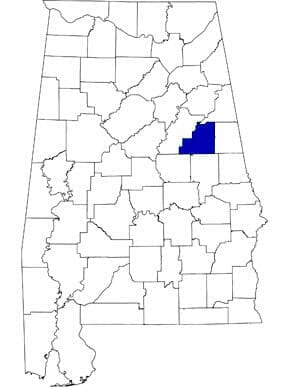 Clay County Map
Comprising approximately 605 square miles, Clay County lies in the east-central part of the state, wholly within the Piedmont Upland physiographic region. Clay County was carved out of lands from Randolph and Talladega Counties. It is bounded to the north by Cleburne County, to the east by Randolph County, to the south by Tallapoosa and Coosa Counties, and to the west by Talladega County. The majority of the western half of Clay County lies within the Talladega National Forest.
Clay County Map
Comprising approximately 605 square miles, Clay County lies in the east-central part of the state, wholly within the Piedmont Upland physiographic region. Clay County was carved out of lands from Randolph and Talladega Counties. It is bounded to the north by Cleburne County, to the east by Randolph County, to the south by Tallapoosa and Coosa Counties, and to the west by Talladega County. The majority of the western half of Clay County lies within the Talladega National Forest.
The Ketchepedrakee Creek, a tributary of the Tallapoosa River, flows through the northern half of the county, and the Little Hillabee Creek, a tributary of the Coosa River, flows through the southern half. Hatchett Creek flows from north to south through the county. State Routes 49 and 9, which run north to south, and State Route 77, which runs east to west, are the county’s only major transportation routes. Ashland-Lineville Airport is the county’s only airport.
Events and Places of Interest
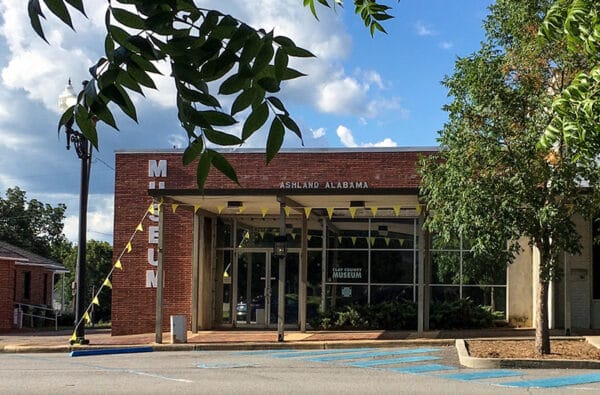 Clay County Museum
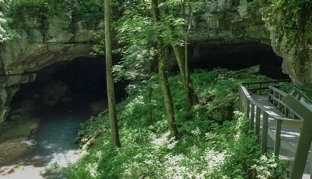
The Historical Museum of Clay County, located near the Ashland city hall, houses exhibits relating to Clay County history. Talladega National Forest covers the western portion of Clay County and offers many outdoor opportunities for nature lovers, as do portions of Cheaha State Park and the Odum and Pinhoti Trails. Lake Wedowee, also known as Harris Lake, is a 10,000-acre impoundment of the Tallapoosa River located along the eastern edge of the county. The lake is home to Flat Rock Park, a swimming, hiking, and fishing areas.
Clay County Museum
The Historical Museum of Clay County, located near the Ashland city hall, houses exhibits relating to Clay County history. Talladega National Forest covers the western portion of Clay County and offers many outdoor opportunities for nature lovers, as do portions of Cheaha State Park and the Odum and Pinhoti Trails. Lake Wedowee, also known as Harris Lake, is a 10,000-acre impoundment of the Tallapoosa River located along the eastern edge of the county. The lake is home to Flat Rock Park, a swimming, hiking, and fishing areas.
Further Reading
- Grundy, Pamela. You Always Think of Home: A Portrait of Clay County, Alabama. Athens: University of Georgia Press, 1991.
- Heritage of Clay County, Alabama. Clanton, Ala.: Heritage Publishing Consultants, Inc., 1998.